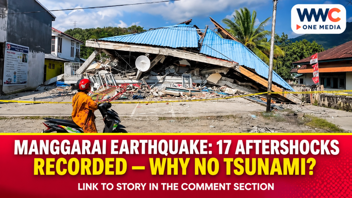
MANGGARAI, Indonesia — Nov. 21, 2026. Indonesia’s Meteorology, Climatology and Geophysics Agency (BMKG) recorded a magnitude-5.8 earthquake near Ruteng in East Nusa Tenggara on Nov. 18, and its official analysis found no tsunami potential from the event. By 12:30 p.m. Western Indonesian Time on the day of the quake, the agency had counted 17 aftershocks, the largest reaching magnitude 4.9.
The distinction is important for coastal communities: an earthquake can produce strong local shaking without generating a tsunami. And a finding of no tsunami potential for this particular event does not remove the need to check damaged buildings, monitor subsequent tremors or respond to future official warnings.
Manggarai earthquake: The measurements behind the alert
BMKG’s main earthquake listing recorded the event at 11:41:32 a.m. Western Indonesian Time, equivalent to 12:41:32 p.m. in East Nusa Tenggara’s Central Indonesian Time zone. It listed a magnitude of 5.8, a depth of 10 kilometres and an initial epicentre at 8.17 degrees south latitude and 120.54 degrees east longitude.
The same official event page includes an updated analysis placing the epicentre at 8.21 degrees south and 120.55 degrees east, approximately 45 kilometres northeast of Ruteng in the sea. Those coordinate differences reflect the published event information and its analytical update; they should not be reported as two separate main earthquakes.
Magnitude measures the size of the earthquake at its source. Depth describes how far below the surface it began. Neither figure, taken alone, tells readers how hard every neighbourhood shook or whether coastal flooding occurred.
What BMKG confirmed about the 17 aftershocks
BMKG’s Nov. 18 statement counted 17 aftershocks by 12:30 p.m. WIB and gave magnitude 4.9 as the strongest in that early monitoring window. This is a time-stamped count, not the eventual total for the entire earthquake sequence.
Aftershocks are subsequent earthquakes associated with the changed stress in the area following a larger event. They may be smaller than the main shock but can still be felt and can present additional risks around weakened structures.
The agency said it would continue monitoring and issue updates through its verified communication channels. It did not announce in that statement that the sequence had ended or provide an exact time when aftershocks would stop. Readers should not interpret the number 17 as a prediction of what would happen next.
The importance of separating preliminary observations from longer-term conclusions also appears in WWC’s report on revised Papua New Guinea earthquake measurements, which concerns a different event and region.
Why the offshore earthquake did not carry a tsunami threat
BMKG’s tsunami modelling concluded that this specific magnitude-5.8 event did not have tsunami potential. Its analytical statement linked the shallow earthquake to the Flores Back-arc Thrust area and identified a normal-fault movement mechanism.
A tsunami assessment looks beyond magnitude. The location, depth and manner of fault movement matter because the central question is whether an earthquake displaces enough seawater to generate dangerous waves. An offshore epicentre is therefore not, by itself, proof that a tsunami will follow.
The conclusion was specific to Nov. 18. It must not be repurposed as a blanket assurance about future earthquakes near Flores. BMKG’s public education guidance still advises coastal communities to recognise natural warning signs, observe official information and evacuate promptly following strong or prolonged shaking when appropriate.
For a different example of how depth affects a tsunami assessment, WWC has covered the deep offshore earthquake near Japan’s Ogasawara Islands. The Japan event should not be confused with the shallower Manggarai earthquake; each requires its own official assessment.
What residents felt across Flores
BMKG’s statement placed reported shaking at intensity IV–V on the Modified Mercalli Intensity scale in Manggarai. It recorded intensity III–IV in West Manggarai and II–III in Ngada. These are descriptions of observed or reported shaking effects in particular areas, not additional earthquake magnitudes.
The official intensity descriptions for the strongest-affected areas included widespread perception of shaking, movement of large objects and some breakage of household items. Actual building damage, injuries and disruption to essential services require separate local assessments; the intensity figures alone do not provide casualty or loss totals.
BMKG advised people to avoid buildings with earthquake-related cracks or other damage and to disregard rumours that cannot be verified. These recommendations remain relevant even though the event was assessed as not capable of producing a tsunami.
WWC’s earlier coverage of Japan’s November earthquake and the uncertainty around subsequent tremors provides another illustration of why immediate safety advice should not be replaced by guesses about the next shock.
Why the distinction matters for disaster communication
Analysis: The clearest public message separates three questions: What did instruments measure? What hazards did the agency assess? What practical precautions should residents take? A no-tsunami assessment answers only the second question for the particular earthquake under review.
That clarity matters because misunderstanding can work in either direction. People may assume every offshore earthquake will create a tsunami, causing needless alarm, or they may incorrectly believe that an event assessed as having no tsunami potential carries no remaining risk at all.
BMKG’s Nov. 18 bulletin supports neither extreme. It provides measured earthquake parameters, a specific tsunami assessment and a continuing warning about aftershocks and compromised buildings. Keeping those statements distinct produces more useful information than treating a single reassuring finding as a general all-clear.
What happens next
BMKG said it would continue monitoring seismic activity and distribute updates through official channels. Any later aftershock total, damage assessment or change in local safety guidance must be established through a newer official record rather than inferred from the early Nov. 18 bulletin.
For residents, the immediate priorities identified by BMKG were to remain calm, avoid cracked or damaged buildings and follow verified earthquake information. Its finding of no tsunami potential applied to the magnitude-5.8 earthquake assessed on Nov. 18, not to every future seismic event.
Frequently asked questions
How strong was the Ruteng earthquake on Nov. 18, 2026?
BMKG recorded a magnitude of 5.8 and a depth of 10 kilometres. Its updated epicentre analysis placed the earthquake offshore, about 45 kilometres northeast of Ruteng.
How many aftershocks were recorded?
BMKG counted 17 aftershocks by 12:30 p.m. Western Indonesian Time on Nov. 18. The largest in that early count measured magnitude 4.9; the figure was not a final sequence total.
Did the earthquake pose a tsunami threat?
No. BMKG’s modelling found no tsunami potential from the particular magnitude-5.8 earthquake. Future earthquakes require separate official assessments.
What should residents do after the earthquake?
Follow verified BMKG updates, avoid buildings that have cracks or other earthquake-related damage and remain alert to additional shaking. BMKG also advises people not to rely on unverified rumours.