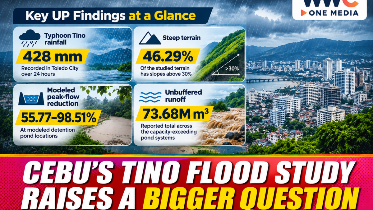
Cebu’s continuing struggle with flooding needs to be examined beyond individual construction projects. A University of the Philippines Diliman research presentation on Nov. 10, 2026, reportedly expanded the assessment of Typhoon Tino’s impact across Metro Cebu’s river basins. However, the complete research paper and its underlying data were not available in the university’s publicly accessible records during verification.
The distinction matters because flood modelling can help explain how rainfall, terrain and land-use changes interact, but it cannot automatically establish legal responsibility for a disaster. Any conclusions about a particular development must remain within the boundaries of the research methods and data.
An official Philippine report submitted to the ESCAP/WMO Typhoon Committee documents the scale of the rainfall during Tino. More than 400 millimetres fell in the Hinulawan River Basin in Cebu from Nov. 3 to 4, 2025. The same report records around 180 millimetres at other monitored locations on the island, including the Guinsay automatic rain gauge and Mactan synoptic station. Typhoon Committee
That rainfall helps explain why the disaster demands a watershed-wide response. Water does not stop at city boundaries, and flood protection in one municipality can affect communities downstream.
Why the watershed matters
A watershed is an area of land where rainwater drains towards a shared river or outlet. Its boundaries are determined by the landscape rather than by barangay, city or provincial borders.
This means that heavy rainfall in upland communities can affect residents far downstream. The amount of water entering a river, the condition of its channels and the capacity of drainage infrastructure all influence how flooding develops.
The official typhoon report also recorded rapid rises in monitored river levels in several Philippine river basins following Tino. It noted increases of around four to six metres in the Ilog-Hilabangan and Jalaur river basins. These figures are not measurements for every Cebu river, but they demonstrate the hydrological effects of the storm across the country. Typhoon Committee
Why one development cannot explain an entire flood disaster
Cebu’s public debate has often focused on hillside construction and stormwater detention facilities. Those issues deserve technical scrutiny, but an assessment of one property cannot substitute for an examination of an entire river basin.
A complete investigation needs to consider rainfall intensity, soil saturation, slope, vegetation, river-channel capacity, drainage networks and changes in land cover.
It must also distinguish between different outcomes. Reducing the peak rate of water flowing into a river is not necessarily the same as reducing the total area inundated or preventing damage to homes.
That distinction is essential when interpreting computer simulations. A model estimates what may happen under specified conditions; it is not, by itself, a court ruling or a finding of legal liability.
Cebu already has unfinished flood-preparedness work
The need for practical action is particularly important because Cebu City continues to face gaps in disaster preparedness.
WWC previously reported that river-monitoring sensors and a proposed evacuation centre remained unfinished one year after Typhoon Tino. The report highlighted the need for earlier warnings, better coordination with neighbouring local governments and safer accommodation for displaced families.
The city’s broader flood-control concerns also include the condition of waterways and the ability of drainage systems to handle heavy rainfall. WWC has separately examined the city’s scrutiny of developers’ flood-mitigation measures and the debate surrounding Monterrazas de Cebu’s stormwater claims.
These are related issues, but they should not be treated as interchangeable evidence. Each project, river system and flood-control measure requires its own technical assessment.
What happens next
The most useful next step is the public release of the completed UP study, including its methodology, model assumptions, watershed maps and recommendations.
Cebu’s local governments should be able to use the research to identify high-risk locations, coordinate drainage and river improvements, protect waterways and assess the cumulative effects of development.
The public also needs measurable implementation targets. These could include completed drainage upgrades, maintained river channels, functioning monitoring systems, protected easements and clearly funded flood-control projects.
The question after Tino is no longer simply where the water came from. It is whether Cebu’s institutions can work together to reduce the risks before another extreme rainfall event.
A watershed does not follow political boundaries. Cebu’s flood-control planning should not either.