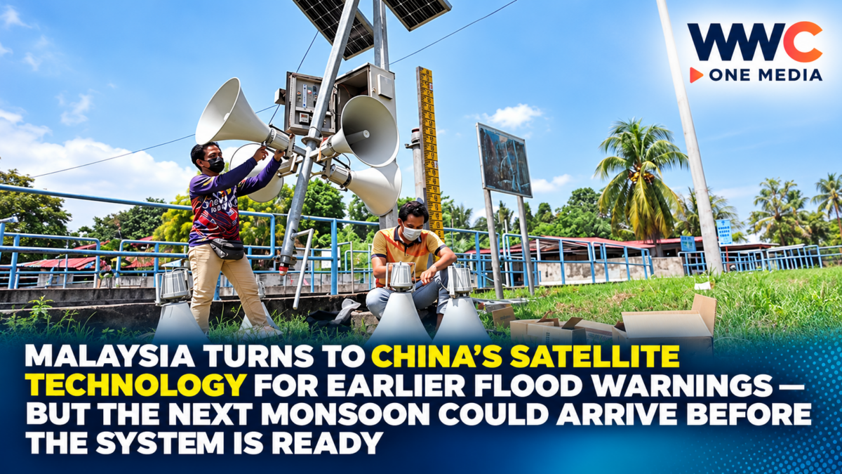
BEIJING / KUALA LUMPUR — October 14, 2026 — Malaysia is seeking advanced satellite-based weather forecasting technology from China in an effort to provide earlier flood warnings, protect vulnerable communities and reduce the economic damage caused by increasingly unpredictable monsoon conditions.
Deputy Prime Minister Datuk Seri Dr Ahmad Zahid Hamidi announced the initiative during a working visit to Beijing on October 13, revealing that China had offered access to sophisticated forecasting systems and equipment.
Malaysia wants to combine the technology with its existing disaster-management infrastructure to improve the accuracy of weather forecasts and give authorities more time to prepare evacuations.
The proposed cooperation could involve technology transfer, technical equipment and closer coordination between Malaysian and Chinese agencies.
However, the announcement comes with an important limitation.
The new capabilities may not be available before the approaching Northeast Monsoon season, meaning Malaysia must rely on its existing forecasting and emergency-response arrangements for the immediate flood threat.
According to Malaysian government broadcaster RTM, officials hope to make the technology available during 2027.
The initiative, also covered by Bloomberg on October 14, highlights Malaysia’s growing interest in using space-based technology to strengthen climate resilience.
China’s satellite systems could help Malaysia detect approaching weather dangers earlier. But the real test is whether the two countries can turn the proposed cooperation into a functioning warning system before another destructive monsoon season puts millions of residents at risk.
Malaysia Seeks China’s Advanced Weather Forecasting Systems
Ahmad Zahid announced the proposed cooperation during a five-day visit to Beijing and Tianjin.
Malaysia is interested in Chinese systems capable of providing more comprehensive weather observations and supporting faster forecasts.
The Deputy Prime Minister said Malaysia’s existing forecasting capabilities could be strengthened through access to more advanced technology.
The Malaysian Meteorological Department, known as MetMalaysia, would be a principal user of the resulting data.
The objective is to identify potentially dangerous weather conditions earlier, particularly when rainfall or strong winds exceed initial forecasts.
More accurate forecasts could help emergency agencies decide when to issue warnings, prepare temporary shelters and organize evacuations.
However, the specific Chinese satellite systems involved have not been publicly identified in the verified announcements.
Neither a procurement value nor a completed deployment contract has been disclosed.
China Offers Technology Transfer, Not Just Satellite Images
The proposed collaboration would go beyond simply receiving weather information.
Malaysia wants access to forecasting systems, equipment and technical expertise that could improve domestic capabilities.
That distinction matters.
Satellite observations can provide information about cloud formations, storm development and atmospheric conditions over extensive areas.
But turning those observations into useful forecasts requires processing systems, trained specialists and reliable operational procedures.
Weather agencies must integrate the data with other information, including ground observations, rainfall measurements and forecasting models.
Technology transfer could help Malaysia develop greater technical capacity over time.
However, the precise scope of training, software access, equipment ownership and operational responsibilities has not yet been finalized publicly.
The agreement remains at the cooperation and implementation-planning stage.
The Biggest Problem: The New System May Miss This Monsoon
The timing presents an immediate challenge.
Malaysia’s Northeast Monsoon season is approaching, bringing the potential for prolonged heavy rainfall and widespread flooding.
Ahmad Zahid acknowledged that the technology might not be ready for use during the upcoming season.
Government broadcaster RTM reported that implementation is being targeted for the following year.
That means the satellite initiative should be viewed as a medium-term improvement rather than an immediate solution to the current flood threat.
Malaysia must continue relying on MetMalaysia, the National Disaster Management Agency and existing emergency-response systems.
The government is also working to improve evacuation facilities and strengthen local disaster preparedness.
Whether the new technology becomes operational in 2027 will depend on the final cooperation arrangements, technical integration and testing.
Why the Northeast Monsoon Is So Dangerous
The Northeast Monsoon is a recurring weather pattern that brings significant rainfall to parts of Malaysia.
The east coast of Peninsular Malaysia is particularly exposed, including areas of Kelantan, Terengganu and Pahang.
Parts of Johor, Sabah and Sarawak may also experience serious flooding.
During periods of prolonged heavy rain, rivers can overflow and drainage systems can become overwhelmed.
Roads and bridges may be cut off.
Homes and businesses can suffer damage.
Residents in low-lying communities may need to evacuate.
Flooding can also affect schools, transportation and agricultural production.
The severity varies between locations and seasons.
An approaching monsoon does not mean every vulnerable community will experience a major flood.
However, early preparation can reduce the consequences when dangerous conditions develop.
Better Satellites Could Give Authorities More Time
Satellite technology can strengthen weather monitoring by providing repeated observations over wide geographical areas.
Forecasters can use such information to track cloud systems, estimate storm development and improve numerical weather predictions.
For flood management, those observations become particularly valuable when combined with local rainfall and river-level information.
Authorities may be able to identify areas at risk before conditions deteriorate.
Emergency planners can then prepare shelters, position equipment and communicate warnings.
But satellite technology is not a stand-alone solution.
A satellite cannot determine the exact flooding impact on every road or household without additional local information.
Forecast accuracy also depends on the quality of models, available observations and how data are interpreted.
The value of Malaysia’s proposed cooperation will depend on the entire warning process, from detection to public communication.
MetMalaysia Will Remain Central to the System
MetMalaysia already provides official weather forecasts and warnings.
Its services include alerts for thunderstorms, continuous rain, strong winds and rough seas.
The Chinese technology would be intended to strengthen those existing capabilities rather than replace Malaysia’s meteorological agency.
An effective system must turn technical forecasts into clear guidance for residents.
For example, a warning should communicate the affected area, expected weather conditions and recommended actions.
Authorities also need systems capable of reaching people quickly.
Information may be distributed through mobile applications, government channels, broadcasters and local emergency services.
For residents in remote areas, accessibility becomes especially important.
Even highly accurate forecasts offer limited protection if warnings arrive too late or fail to reach the communities at risk.
NADMA Prepares for Another Flood Season
Malaysia’s National Disaster Management Agency, or NADMA, coordinates disaster preparedness and response.
Ahmad Zahid said preparations are taking place at federal, state and district levels.
The government has been improving temporary evacuation centres to accommodate people displaced by floods.
Permanent evacuation facilities have also been developed.
Some of these facilities can be used for community or school activities outside emergency periods.
That approach aims to make better use of public infrastructure while maintaining readiness for disasters.
Authorities have also conducted preparedness activities with MetMalaysia and local disaster committees.
The focus includes identifying high-risk locations and improving evacuation arrangements.
The satellite proposal is intended to strengthen this broader system rather than serve as its sole foundation.
Malaysia Reports Flood Losses Falling From RM960 Million to RM600 Million
Ahmad Zahid cited a decline in flood-related losses between 2024 and 2025.
According to his figures, losses fell from approximately RM960 million in 2024 to RM600 million in 2025.
| Flood-loss comparison | Reported amount |
|---|---|
| 2024 | RM960 million |
| 2025 | RM600 million |
| Reduction | RM360 million |
| Percentage decline | 37.5% |
The Deputy Prime Minister attributed the improvement in part to stronger preparedness measures.
However, the decline should not be attributed entirely to disaster-management improvements without further analysis.
Flood losses also depend on rainfall intensity, which areas are affected, the value of damaged assets and the scale of individual events.
The figures were cited by the Deputy Prime Minister and are not an independently established measure of the impact of the proposed Chinese satellite technology.
That technology has not yet been deployed under the new initiative.
Why Earlier Warnings Matter Economically
Floods create costs far beyond damage to residential buildings.
Factories may need to suspend operations.
Businesses can lose inventory and equipment.
Road disruptions may delay deliveries.
Farmers can suffer crop losses.
Public infrastructure may require expensive repairs.
Families displaced from their homes may also face temporary housing and transportation costs.
Early warnings can help reduce some of these losses.
Businesses may have time to move equipment or protect stock.
Residents may secure important documents and essential belongings.
Emergency personnel can prepare for evacuations before conditions become more dangerous.
But forecasts cannot stop rainfall or eliminate every form of property damage.
Long-term flood resilience also requires drainage systems, land-use planning, protective infrastructure and community preparedness.
Malaysia Proposes a Wider Disaster Cooperation Agreement
The initiative also has a diplomatic dimension.
Malaysia has proposed a bilateral framework with China for disaster cooperation.
According to The Star, the proposal includes mutual legal assistance arrangements concerning national emergencies.
The cooperation could involve technical assistance and broader coordination between relevant agencies.
Ahmad Zahid said he expected discussions with Chinese officials, including Public Security Minister Wang Xiaohong, during his visit.
The broader relationship may provide Malaysia with access to technology and expertise that would otherwise require substantial domestic development.
However, the public reporting does not establish that every proposed component has already been finalized in a binding agreement.
The details of financing, implementation and accountability remain important issues to clarify.
China Expands Its Regional Technology Influence
China has made substantial investments in its space program, weather monitoring and Earth-observation capabilities.
Satellite applications extend beyond national security and communications.
They can also support agriculture, weather forecasting, environmental monitoring and disaster management.
Malaysia’s interest reflects the increasing importance of advanced data systems in public services.
For China, cooperation can strengthen its technological partnerships with Southeast Asian countries.
For Malaysia, access to additional observations and forecasting tools may improve disaster response.
However, international technology cooperation also raises practical questions.
Authorities must understand data access conditions, system compatibility, maintenance requirements and long-term costs.
These issues are not evidence of wrongdoing.
They are standard considerations when a government adopts foreign-developed critical technology.
Better Forecasts Require Local Data and Effective Communication
The potential benefits depend on how different systems work together.
Satellites provide large-scale observations.
Ground-based rainfall stations and weather radar supply more detailed local information.
River gauges track changing water levels.
Hydrological models help estimate where flooding might develop.
Emergency agencies then translate those forecasts into decisions.
A warning may be issued earlier, but officials still need to determine whether evacuation is necessary.
The public also needs reliable guidance about where to go and what precautions to take.
Poorly communicated warnings can cause confusion.
Excessive false alarms may also reduce trust.
Malaysia will therefore need to assess the accuracy and usefulness of the new system through real-world testing.
Can Satellite Technology Prevent Another Major Flood Disaster?
The short answer is that it can improve preparedness, but it cannot prevent floods on its own.
Forecasting systems are valuable because they provide information before a hazard reaches communities.
Their success depends on whether people and institutions act on that information.
Local authorities must maintain evacuation routes.
Shelters need sufficient capacity and supplies.
Emergency responders require equipment and communication systems.
Communities must know what official warnings mean.
Buildings and infrastructure must also be designed to withstand local flood exposure.
The Chinese technology could become an important additional tool within that framework.
Its actual impact will only become measurable after deployment and operational evaluation.
A Growing Challenge for Southeast Asia
Malaysia’s initiative is relevant to other ASEAN countries exposed to extreme rainfall and flooding.
Indonesia, Thailand, Vietnam and the Philippines all face weather-related disasters that can damage communities and disrupt economic activity.
Regional cooperation on forecasting and early warnings can potentially improve preparedness.
Weather systems frequently cross national boundaries.
Data sharing may therefore provide useful information beyond a single country.
However, different countries have distinct geography, infrastructure and institutional capacity.
A technology that works well in one environment may require adaptation elsewhere.
Effective implementation needs local expertise as well as international support.
What the Philippines Can Learn
The Philippines has extensive experience with severe weather, including tropical cyclones, monsoon rains and flooding.
Its own disaster-warning system depends on meteorological forecasts, flood monitoring and communication among government agencies.
Malaysia’s proposed partnership highlights the potential value of stronger satellite data, forecast models and international technology cooperation.
But the technology announcement does not establish that the Philippines will receive the same system or join the bilateral arrangement.
For Philippine policymakers, the main lesson is that early-warning capability is only one part of disaster readiness.
Forecast accuracy, local data, public communication, evacuation planning and resilient infrastructure must work together.
The objective is not simply to identify dangerous weather earlier.
It is to ensure that earlier information produces faster and more effective action.
What Happens Next?
Several important developments will determine the success of Malaysia’s initiative.
Finalizing cooperation: Malaysia and China must establish the scope of technology transfer and operational responsibilities.
Deployment timetable: Officials have suggested that implementation may occur in 2027, but no binding completion date has been confirmed.
Technical integration: MetMalaysia will need to determine how new data and forecasting systems can complement existing tools.
Training and maintenance: Personnel must be able to operate and maintain the technology reliably.
Monsoon preparedness: NADMA and local authorities must continue using current systems during the approaching season.
Public-warning performance: The program’s ultimate success will depend on whether improved forecasts lead to timely warnings and effective evacuations.
These milestones will show whether the initiative becomes a meaningful disaster-prevention investment.
The Bigger Question: Can Malaysia Stay Ahead of Its Next Flood Crisis?
Malaysia’s pursuit of Chinese satellite technology reflects a growing recognition that disaster preparedness must keep pace with increasingly challenging weather conditions.
Advanced forecasting systems could give authorities more information and additional time to protect communities.
The potential benefits include earlier evacuations, better resource deployment and reduced financial losses.
But the announcement also reveals an uncomfortable timing problem.
The new technology may arrive too late to help during the approaching Northeast Monsoon.
Malaysia must therefore strengthen existing emergency arrangements while preparing for a longer-term technological upgrade.
The planned cooperation is promising, but its effectiveness remains unproven until the system is deployed and tested.
Malaysia is turning to China’s satellite technology to get ahead of dangerous floods, potentially giving communities more time to prepare. But the biggest question is still unresolved: Can the country translate advanced forecasts into faster evacuations and lower losses—or will another destructive monsoon expose the limits of its disaster-warning system before the new technology becomes operational?