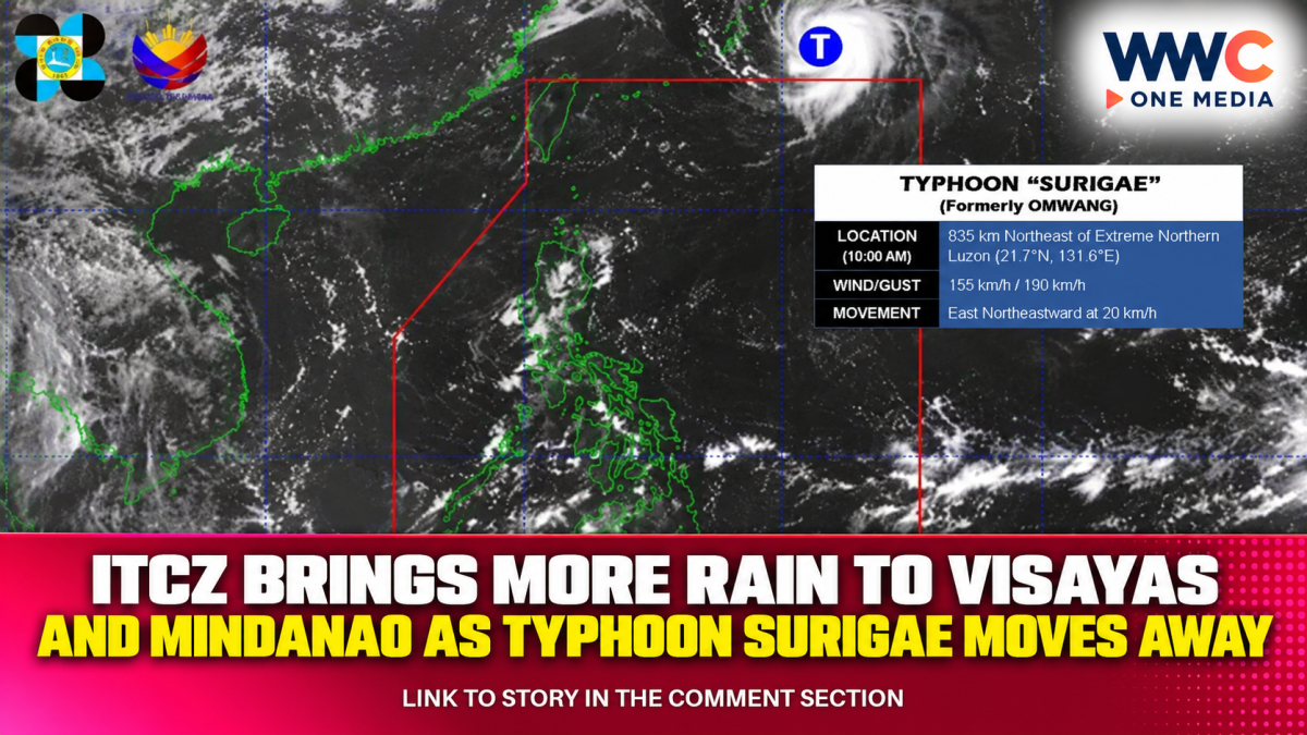
The Intertropical Convergence Zone is bringing another round of rain and thunderstorms across parts of the Visayas and Mindanao, even as Typhoon Surigae moves farther away from the Philippines after leaving the country’s area of responsibility.
PAGASA said the ITCZ is affecting Palawan, the Visayas and Mindanao, with cloudy skies, scattered rain and thunderstorms expected over the Visayas, Zamboanga Peninsula, Northern Mindanao, Caraga, Lanao del Sur and Basilan.
The weather bureau warned that moderate to occasionally heavy rainfall could trigger flash floods and landslides, particularly in areas already vulnerable to flooding or where thunderstorms become severe.
Palawan and the rest of Mindanao are expected to experience partly cloudy to cloudy conditions with isolated rain showers or thunderstorms. Metro Manila and the rest of Luzon may also see isolated thunderstorms, although these are expected to be mainly associated with localized weather activity rather than the ITCZ.
The latest rainfall comes as Surigae, known locally as Typhoon Queenie while inside the Philippine Area of Responsibility, has already exited PAR. PAGASA said the typhoon was located far northeast of Luzon and was moving away from the country.
Surigae was still a powerful system after leaving PAR, but PAGASA said it would no longer directly affect Philippine weather conditions. Its departure means the continuing rain over much of the southern and central Philippines is primarily being driven by the ITCZ rather than the typhoon itself.
The ITCZ is a zone where winds from different directions converge, forcing warm, moist air upward and producing clouds, thunderstorms and periods of heavy rainfall. Its position can shift over time, allowing affected areas to experience changing rainfall conditions.
PAGASA’s extended outlook indicates that wet conditions may persist beyond Monday. On Tuesday, most of the Visayas, Caraga and Northern Mindanao are expected to continue experiencing cloudy skies with scattered rain and thunderstorms, while another weather disturbance east of the Philippines could contribute to additional rainfall later in the week.
The forecast is particularly relevant for communities in low-lying and mountainous areas. Heavy bursts of rain can quickly overwhelm drainage systems and increase the risk of flooding, while saturated slopes can become more susceptible to landslides.
Residents in affected provinces have therefore been advised to continue monitoring official weather bulletins, rainfall warnings and local government advisories, particularly during periods of persistent or intense thunderstorms.
For commuters, motorists and travellers, sudden downpours could also lead to reduced visibility, slippery roads and localized flooding. Conditions may vary significantly between nearby areas because thunderstorms can develop unevenly.
The latest weather pattern highlights how the end of a tropical cyclone’s direct influence does not necessarily mean an immediate return to settled weather. With the ITCZ remaining active, parts of the Visayas and Mindanao could continue experiencing rain and thunderstorms even after Surigae has moved well away from the country.
The bigger concern now is whether persistent ITCZ-driven rainfall will produce repeated episodes of flooding and landslides across vulnerable areas as another period of unsettled weather develops over the Philippines.