
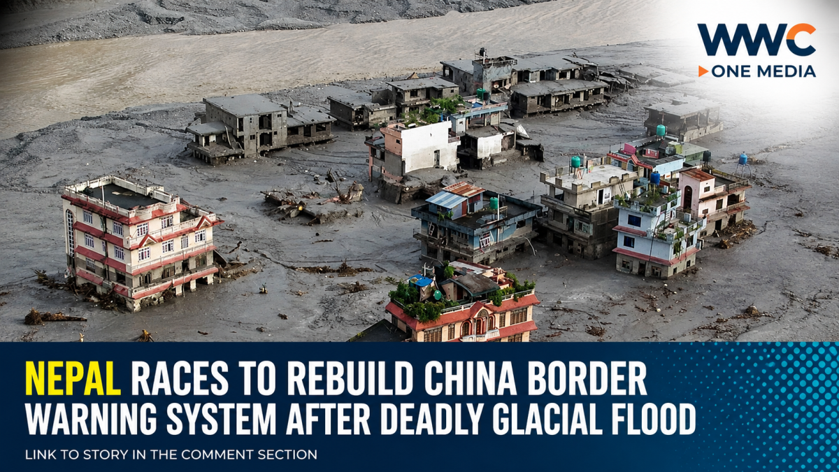
Nepal is moving to rebuild an early-warning system along its border with China after a catastrophic glacial flood killed more than 1,100 people and left thousands missing, exposing major gaps in disaster monitoring and communication.
Two Nepali government sources told Reuters that the new system will use seismic sensors, cameras and satellite communications to detect landslides and other dangers in the unstable Himalayan terrain. The first equipment is being installed in Timure, in Nepal’s Rasuwa district, near the area devastated by the recent flood.
The planned satellite connection, known as VSAT, is designed to keep monitoring stations connected even if mobile networks are knocked out. That became a critical problem during the disaster, when at least four monitoring stations near the border were destroyed or stopped transmitting.
Warning came too late
The Aug. 26 disaster sent an enormous surge of water, mud and rock through Himalayan valleys after a collapse involving glacier ice and bedrock.
CNA reported that the flood reached a border crossing at about 8:32 a.m., while a public mobile alert was not issued until around 9:13 a.m. Monitoring equipment had already stopped transmitting, making it difficult for officials to immediately determine what was happening upstream.
Reuters reports that Nepal now believes a rebuilt system could provide only a few minutes of warning during a future landslide-triggered flood. Officials nevertheless say even those minutes could be critical for downstream communities.
Thousands remain missing
The disaster has become one of the most devastating natural catastrophes to hit the Himalayan region in recent years.
Reuters reported that at least 1,114 people had been killed in Nepal, with nearly 4,000 still unaccounted for. Across the border in Tibet, China reported 21 deaths and hundreds of people missing.
China has also been carrying out major rescue operations after reopening the road to the Gyirong border area. Heavy machinery, search dogs and life-detection equipment have been deployed, although persistent rain, unstable cliffs and difficult terrain continue to hamper the search.
Nepal wants closer data sharing with China
The disaster has also highlighted the importance of cross-border cooperation.
Nepal had previously sought more detailed, real-time information from China about glacier movements and water levels. Following the disaster, officials are looking to strengthen information sharing so that warnings can reach communities on both sides of the border faster. China has said it shared satellite imagery, hydrological data and information about upstream barrier lakes after the disaster.
The issue is especially important because rivers, glaciers and unstable mountain slopes do not stop at international borders.
Climate risks are growing
The disaster is also intensifying concerns about the Himalayan region’s vulnerability to climate change.
The Associated Press reported that warmer temperatures are contributing to faster glacier melt and increasing the potential for interconnected hazards such as rockslides, avalanches, landslides and flash floods. Scientists caution, however, that it is too early to directly attribute this specific disaster to global warming.
The Hindu Kush Himalaya contains enormous amounts of ice and supplies river systems that support nearly 2 billion people, making the consequences of increasingly unstable mountain environments potentially far-reaching.
For Nepal, the lesson from the disaster is increasingly clear: rebuilding roads and homes alone will not be enough. Stronger monitoring, reliable communications and rapid cross-border warnings could determine whether communities have minutes to escape the next catastrophe.
WWC ONE MEDIA J.M.D



Leave a Reply