
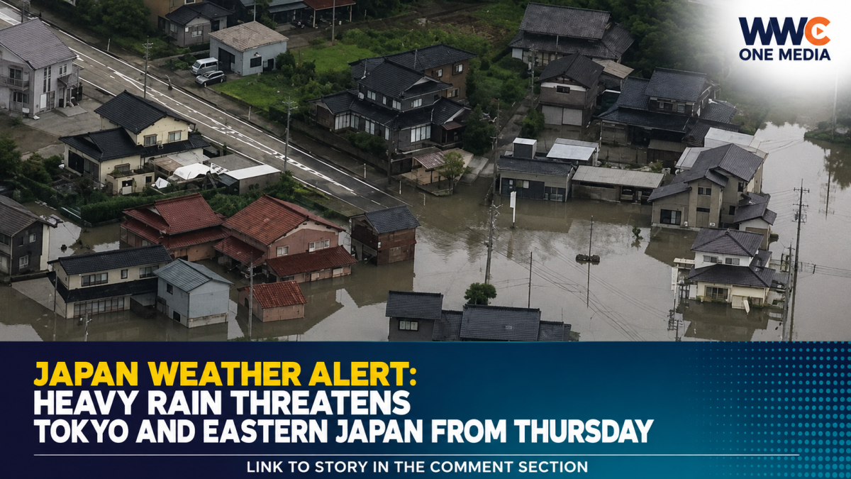
Parts of eastern Japan, including the Tokyo region, are facing a growing risk of heavy rain from Thursday as a seasonal rain front moves southward and warm, moisture-rich air pushes in from the south.
Japan’s Meteorological Agency is warning that atmospheric conditions across the Kanto Koshin region could become highly unstable, raising the risk of intense rainfall, flooding and landslides.
Heavy rain could persist for several days
The Kanto Koshin region, which includes Tokyo, northern and southern Kanto, and the Koshin area, could see periods of heavy rain from Thursday through Saturday and potentially beyond.
According to the forecast cited by NHK, rainfall through Thursday evening could reach as much as 80mm in parts of northern Kanto and Koshin and 60mm in southern Kanto.
Additional heavy rainfall is expected through Friday, with some areas potentially receiving another 100mm over 24 hours. Parts of Kanto Koshin and the Izu Islands could see totals of around 100–120mm through Saturday evening.
Other Japanese forecasts are also warning that the rain could become more widespread and intense. Weathernews reported that the autumn rain front is expected to slowly move southward on Thursday, bringing rain across broad areas of Japan.
Tokyo could see thunderstorms and intense downpours
Tokyo is not expected to escape the worsening conditions.
A forecast issued by Japan’s Meteorological Agency and reported by FNN says Tokyo could experience rain from Thursday, with locally heavy showers accompanied by thunderstorms from the afternoon into the evening.
Forecasters are particularly concerned about sudden increases in rainfall because saturated ground and rapidly rising waterways can increase the risk of flooding and landslides.
Tropical Storm Krovanh adds another layer of uncertainty
The situation is being closely watched because Tropical Storm Krovanh is moving northward over the Philippine Sea.
Weather data published on Sept. 2 showed Krovanh south of Japan, with the storm expected to move toward the Ryukyu Islands and then curve back toward waters south of Kyushu. Its movement could help transport additional tropical moisture toward Japan and influence the rain front.
Importantly, this does not mean Krovanh is forecast to directly hit Tokyo. Rather, its circulation and interaction with the seasonal front could contribute to a prolonged period of unstable weather.
Japan’s Meteorological Agency explains that tropical-cyclone forecasts are updated regularly because changes in a storm’s track and intensity can significantly affect the potential impact on Japan.
Authorities urge people to prepare
Officials are warning residents to remain alert for:
- Flooding in low-lying areas
- Rising and overflowing rivers
- Landslides
- Lightning
- Sudden, damaging wind gusts
- Hail
- Rapidly developing thunderstorms
The greatest concern is not necessarily one single burst of rain, but the possibility of repeated rainfall over several days. When heavy rain continues, rivers and soil can become increasingly saturated, making subsequent downpours more dangerous.
Residents in vulnerable areas are being urged to monitor official weather and disaster information and be prepared to move to safer locations if evacuation guidance is issued.
The latest forecasts suggest the weather could remain unsettled well beyond Thursday, with Japan’s weather services warning that the combination of the stationary rain front and tropical moisture could make rainfall totals higher than initially expected.
What happens next could depend on the front and Krovanh
For Tokyo and other parts of eastern Japan, Thursday may mark the beginning rather than the end of the threat.
As the rain front moves and Krovanh continues its approach through the western Pacific, even small changes in the storm’s track could affect where the heaviest rain develops.
The key question now is: Could Tokyo and eastern Japan be facing several days of increasingly dangerous rainfall?
WWC ONE MEDIA J.M.D




Leave a Reply