
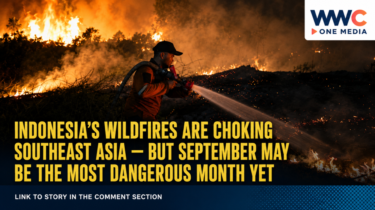
JAKARTA — Indonesia’s worsening forest and land fires have turned into a regional air-quality crisis, sending smoke across international borders, disrupting schools and flights, and exposing millions of people to unhealthy air.
But the most worrying part may be what comes next.
Indonesian officials and climate experts say September could prove to be one of the most critical periods of the 2026 fire season as an exceptionally strong El Niño combines with prolonged dry weather across major parts of Sumatra and Kalimantan.
Indonesia’s Forestry Ministry says approximately 202,000 hectares of forest and land burned between January and July, already surpassing the area affected during the same period in several recent fire years. Nearly 94,539 hectares burned in July alone, meaning almost half of the January-to-July total was recorded in a single month.
The numbers remain far below Indonesia’s catastrophic 2015 haze crisis, when about 2.6 million hectares burned. But officials are reluctant to declare the worst over because Indonesia is still moving through its peak dry-season window.
A Fire Crisis That Is No Longer Just Indonesia’s Problem
Smoke from fires in Sumatra and Kalimantan has crossed borders into Malaysia, Brunei and the Philippines, transforming what begins as a land-management and environmental problem inside Indonesia into a wider Southeast Asian health emergency.
Malaysia’s Sarawak state has experienced some of the region’s most severe conditions. On September 4, the Air Pollutant Index in Serian surged to 495, only five points below the level at which authorities have said an emergency declaration could be considered.
Kuching, Samarahan and Sri Aman were also reporting very unhealthy air. Earlier in the haze episode, hundreds of schools in Sarawak were closed as smoke blanketed large parts of the state.
Singapore is now feeling the effects as well.
At 7am on September 4, Singapore’s 24-hour Pollutant Standards Index reached 101 in the central region, entering the Unhealthy range. Singapore’s National Environment Agency said it was the first time the PSI had entered the Unhealthy range because of haze since October 8, 2023.
Government agencies subsequently activated haze response measures and said daily air-quality advisories would resume.
The smoke has travelled even farther.
Philippine environmental officials have linked haze affecting parts of the country to smoke and fine particulate matter carried from fires in Kalimantan by the southwest monsoon.
Authorities reported elevated PM2.5 levels in areas including Metro Manila and advised residents — particularly children, older people and those with respiratory or cardiovascular conditions — to reduce prolonged outdoor activity when pollution levels are elevated.
The Philippines’ Environmental Management Bureau later said conditions in Metro Manila had improved somewhat as winds shifted, although parts of the Visayas and Mindanao remained exposed to the changing smoke plume.
1.4 Million Indonesian Students Forced Online
Inside Indonesia, the crisis is already disrupting daily life on a massive scale.
Reuters reported on September 2 that approximately 1.4 million students across six Indonesian provinces had been shifted to remote learning because of dangerous haze and worsening air quality.
Flights have also faced disruption, particularly around Pontianak in West Kalimantan, where thick smoke has reduced visibility.
For communities close to burning peatlands, extinguishing the fires is particularly difficult.
Healthy peatland is naturally wet and resistant to burning. But when peat is drained for agriculture, plantations or other land uses, it can dry out and ignite.
Unlike an ordinary surface fire, peat can continue smouldering underground, sometimes long after flames at the surface appear to have disappeared. These fires can produce large amounts of fine particulate pollution and carbon emissions while remaining extraordinarily difficult to extinguish.
That makes rainfall one of the most important variables in determining how quickly the crisis can be brought under control.
And there is no guarantee enough rain will arrive soon.
Why September Could Be the Turning Point
Indonesia’s meteorological agency BMKG reported that the three-month ENSO index for June through August showed a very strong El Niño, while its September outlook indicated a high probability of extremely low rainfall across parts of southern Sumatra, Kalimantan and several other regions.
BMKG has also warned that the current El Niño could persist into early 2027, while a positive Indian Ocean Dipole can further reinforce dry conditions in parts of Indonesia.
The combination matters because dry vegetation can ignite more easily, while depleted water tables make peat increasingly vulnerable.
Forestry Minister Raja Juli Antoni has repeatedly identified September as a crucial period for controlling the fires.
The danger is reflected in Indonesia’s own satellite monitoring.
The Forestry Ministry said 805 high-confidence hotspots were detected nationwide on September 2, with West and Central Kalimantan remaining among the areas of greatest concern. The ministry stressed that a satellite hotspot is an indication of abnormal surface heat and should not automatically be counted as a separate wildfire.
That distinction is important: hotspot totals can reveal trends and areas requiring investigation, but they are not interchangeable with the number of individual fires or hectares burned.
Investigators Are Looking at Companies — And Alleged Deliberate Burning
Weather alone does not explain Indonesia’s recurring haze problem.
Land clearing using fire has long been identified as one of the major causes of forest and peatland fires in Indonesia, particularly where agriculture or plantations expand into fire-prone landscapes.
Indonesian authorities are investigating both individuals and companies.
Reuters reported that the Environment Ministry was inspecting 19 companies linked to fires covering about 11,047 hectares of concession land, while satellite analysis had identified 42 companies considered at high risk.
An Indonesian environment official said companies could face strict liability when fires occur inside concession areas regardless of whether investigators ultimately determine that they were started intentionally or accidentally.
Indonesia’s Forestry Ministry separately announced administrative sanctions against six companies after fires were identified across more than 1,500 hectares of areas they managed in West, Central and East Kalimantan. One company had its business permit suspended.
Police enforcement has expanded as well. AP reported that dozens of people have been arrested or investigated over suspected illegal burning and land clearing during the current crisis.
The enforcement campaign highlights one of the fundamental questions surrounding Indonesia’s haze problem: how much can emergency firefighting accomplish if land practices that repeatedly create ignition risks are not addressed?
Indonesia Is Throwing Thousands of People and Dozens of Aircraft at the Fires
Indonesia has dramatically expanded its response.
Authorities have deployed tens of thousands of personnel, aerial water-bombing aircraft, ground crews, patrols and weather-modification operations.
Reuters reported that 34 aircraft were conducting water-bombing missions, while Indonesia authorised dozens of foreign aircraft to enter its airspace to support firefighting operations.
Malaysia and Indonesia have also cooperated on cloud-seeding operations aimed at producing rainfall over affected areas. Indonesia opened its airspace for Malaysian operations in August as the transboundary haze intensified.
There are signs that aggressive intervention can make a difference locally.
Indonesia’s Forestry Ministry said Riau recorded zero high-confidence hotspots on September 2, even as serious concentrations remained elsewhere, particularly in Kalimantan.
But weather conditions could erase those gains quickly if new fires are started.
The Comparison Everyone Fears: 2015
For Southeast Asia, every major Indonesian haze episode inevitably brings comparisons with 2015.
That year, fires burned approximately 2.6 million hectares across Indonesia and generated one of the region’s worst environmental disasters.
The 2026 burned area remains nowhere close to that scale based on confirmed data available so far.
But the trajectory is what worries experts.
Indonesia had already recorded around 202,000 hectares burned through July before entering what authorities consider the most dangerous stretch of the dry season. BMKG says very strong El Niño conditions remain in place, while dry conditions are expected across many fire-prone areas during September.
And the smoke is already crossing borders.
Singapore has entered unhealthy PSI territory. Malaysian communities have experienced hazardous air. Philippine authorities have issued haze-related health warnings. Millions of Indonesian students have been affected.
That makes the next few weeks more than a firefighting test for Jakarta.
They are becoming a test of whether years of peat restoration, corporate enforcement, early-warning systems and regional haze agreements have made Southeast Asia more resilient than it was during previous crises.
Indonesia has not returned to 2015.
The question now is whether September will keep it that way.



Leave a Reply