
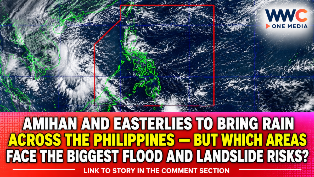
MANILA, Philippines — Two prevailing weather systems are bringing rain to several parts of the Philippines on Thursday, November 12, as the northeast monsoon, locally known as amihan, affects Northern and Central Luzon while easterlies influence the rest of the country.
The Philippine Atmospheric, Geophysical and Astronomical Services Administration (PAGASA) warned that moderate to occasionally heavy rainfall could trigger flash floods and landslides in some areas, particularly communities exposed to persistent rain, steep slopes and overflowing waterways.
But there is an important distinction behind the forecast: these are two weather systems, not two approaching tropical cyclones. PAGASA said it was not monitoring a low-pressure area that could develop into a tropical cyclone as of November 12.
The latest outlook therefore calls for vigilance against localized rainfall hazards, rather than suggesting that a new storm is about to make landfall.
Which areas are expected to receive rain?
PAGASA’s 4 a.m. forecast identified several areas where cloudy skies, rain showers and thunderstorms are expected.
Areas affected by the easterlies
Eastern Visayas, Caraga and the Davao Region, along with Quezon, Camarines Norte and Catanduanes, are forecast to experience cloudy skies with scattered rain showers and thunderstorms.
PAGASA warned that moderate to at times heavy rainfall in these areas could lead to flash floods or landslides.
Areas affected by the northeast monsoon
Cagayan Valley, Apayao, Kalinga, Mountain Province, Ifugao and Aurora are expected to experience cloudy skies with rain due to the northeast monsoon.
These areas also face possible flash floods and landslides during periods of moderate to heavy rainfall.
Meanwhile, the Ilocos Region, the rest of Central Luzon and the rest of the Cordillera Administrative Region may experience partly cloudy to cloudy skies with isolated light rains.
Metro Manila and other parts of the country are generally forecast to have partly cloudy to cloudy skies, with isolated rain showers or thunderstorms. Severe thunderstorms could still cause localized flooding or landslides.
The forecast does not mean that every location in these regions will experience continuous rain. Conditions can vary from one locality to another, and thunderstorms may develop in isolated areas.
Why two weather systems can affect different parts of the country
The northeast monsoon and easterlies are distinct weather patterns that influence the Philippines in different ways.
The northeast monsoon, or amihan, is associated with cooler winds coming from the northeast. It commonly affects Northern and Central Luzon during the cooler months, bringing cloudy conditions and rainfall to areas exposed to the prevailing wind.
The easterlies are winds coming from the Pacific Ocean. They can carry warm, moisture-laden air toward the country, contributing to cloud formation, rain showers and thunderstorms, particularly over eastern sections of the Philippines.
When these systems affect the country at the same time, rainfall can occur in different regions for different meteorological reasons.
PAGASA’s weekly outlook issued on November 6 also anticipated unsettled conditions from November 12 to 13, including scattered rains and isolated thunderstorms over parts of Bicol, Eastern Visayas and Caraga, with the amihan and easterlies influencing other areas.
No tropical cyclone or developing low-pressure area being monitored
Despite the rainy conditions, PAGASA said it was not monitoring any low-pressure area that could develop into a tropical cyclone as of Thursday.
The Philippine News Agency independently reported the same assessment, noting that the weather bureau did not identify a developing low-pressure area that could become a tropical cyclone.
This is an important clarification for residents following the weather situation. Rainfall caused by monsoon winds and easterlies should not automatically be interpreted as evidence of an approaching tropical storm.
The absence of a monitored tropical cyclone, however, does not eliminate the possibility of dangerous weather. Severe thunderstorms and periods of moderate to heavy rain can still produce sudden flooding and landslides.
Coastal conditions may become rough in parts of Luzon and the Visayas
PAGASA also warned that moderate to strong winds are expected over the eastern sections of Luzon and the Visayas.
Coastal waters in these areas may become moderate to rough, with wave heights forecast at approximately 1.8 to 3.1 metres.
The rest of the country is expected to experience light to moderate winds and generally slight to moderate coastal conditions, with forecast wave heights ranging from around 0.6 to 2.5 metres.
Fisherfolk, operators of small boats and other people travelling by sea should check the latest marine forecasts before heading out, particularly when operating in exposed coastal waters.
Flooding and landslide risks remain the immediate concern
For communities in areas identified by PAGASA, the main concern is the possibility of sudden flooding and landslides during periods of moderate to heavy rain.
Residents in low-lying communities should monitor water levels in nearby rivers and drainage channels. Those living near slopes, hillsides and areas with a history of landslides should remain alert for warning signs such as ground cracks, unusual water seepage, leaning trees or sudden changes in the flow of streams.
Motorists should avoid attempting to cross flooded roads, especially when the depth and strength of moving water cannot be determined.
Local government units and disaster-response offices should also continue monitoring vulnerable communities and be prepared to issue evacuation instructions when conditions warrant.
The importance of preparedness is underscored by the country’s recent experience with destructive weather events. In its report, 9.6 Million Filipinos Hit by Habagat and 4 Cyclones — But the Flood Crisis Is Far From Over, WWC ONE MEDIA examined the widespread impact of prolonged rainfall and tropical cyclones on communities across the country.
The risks also extend beyond immediate flooding. Storm Damage in the Philippines Hits P12.4 Billion — But the Biggest Cost May Come After the Floodwaters Disappear documented the wider consequences of severe weather for infrastructure, agriculture and affected households.
In Cebu, the need for stronger preparedness remains a concern. Cebu City Still Not Flood-Ready One Year After Typhoon Tino — Warning Sensors and Evacuation Centre Remain Unfinished reported on continuing gaps in flood-warning and evacuation infrastructure.
The broader challenge is not limited to one weather system. As discussed in The Storm Hasn’t Arrived Yet—But LGUs Are Being Told to Act Now Before It’s Too Late, disaster preparation needs to begin before severe weather reaches vulnerable communities.
At the same time, the country faces a complicated climate outlook. Philippines Moves to Seek Global Climate Funding as DENR, UNDP Launch Disaster-Loss Strategy — But Will Billions Reach Families Before the Next Catastrophe? examines efforts to strengthen the country’s response to climate-related losses and damage.
Rainfall outlook must be monitored alongside the wider climate picture
The rainy conditions come as PAGASA has also warned of a very strong El Niño event in the tropical Pacific, expected to persist into the first half of 2027.
The agency’s November climate outlook indicated that below-normal to way-below-normal rainfall was expected over much of the country during the month.
That does not mean rain cannot occur during El Niño. Individual weather systems, monsoon activity and thunderstorms can still bring heavy rainfall to particular areas even when the broader climate pattern points to below-normal rainfall over a longer period.
This distinction is important: short periods of intense rain can create immediate flooding risks, while prolonged rainfall deficits can still threaten water supplies and agriculture.
For November 12, PAGASA’s message is clear. The amihan and easterlies are keeping parts of the country unsettled, and residents in vulnerable areas should remain alert for heavy downpours, flash floods and landslides.
The public should continue checking PAGASA’s latest daily forecasts, rainfall advisories and marine warnings, since weather conditions can change and localized thunderstorms may develop even in areas outside the main zones of scattered rain.
The immediate threat is not a newly developing tropical cyclone, but the possibility that localized heavy rain could still turn dangerous for communities caught in its path.