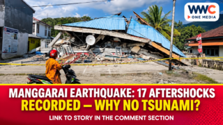
MANGGARAI, Indonesia — A magnitude-5.8 earthquake struck offshore near Ruteng in Indonesia’s East Nusa Tenggara province on Nov. 18, 2026, prompting warnings about further shaking. Indonesia’s Meteorology, Climatology and Geophysics Agency (BMKG) said its modelling found no tsunami potential from the earthquake, but that finding did not settle every question about impacts on the ground.
The distinction matters in a region already managing earthquake recovery. A scientific assessment of tsunami potential addresses a particular hazard; it is not a survey of every building, household or public facility exposed to shaking. Public information about the Ruteng earthquake therefore needs to separate what was measured, what authorities assessed and what remains unconfirmed.
Ruteng earthquake: What the instruments recorded
BMKG’s Nov. 18 event listing recorded the earthquake at 11:41:32 a.m. Western Indonesian Time, or 12:41:32 p.m. in East Nusa Tenggara. The initial published coordinates were 8.17 degrees south and 120.54 degrees east, with a depth of 10 kilometres.
The agency’s detailed analysis subsequently placed the epicentre at 8.21 degrees south and 120.55 degrees east, about 45 kilometres northeast of Ruteng in the sea. Both coordinate sets appear in the official event information. They are not evidence that two magnitude-5.8 mainshocks occurred.
The earthquake was classified as shallow. BMKG linked it to activity associated with the Flores Back-arc Thrust and described the source movement as a normal-fault mechanism. Those are descriptions of the earthquake’s geological setting and rupture, not measurements of damage to homes or other structures.
How strongly did residents feel the shaking?
BMKG placed the reported intensity in Manggarai at IV–V on the Modified Mercalli Intensity scale. West Manggarai registered III–IV, while Ngada registered II–III. These values describe how strongly a quake is experienced in different places, rather than giving each district its own earthquake magnitude.
At the stronger end of the reported intensity range, shaking may be widely noticed and unsecured objects may move or fall. However, an intensity classification does not establish how many properties were damaged. That requires inspection and verified local impact reporting.
This is the same editorial distinction that matters when reporting seismic activity in Davao Occidental: a geological reading and a verified loss assessment answer different questions. The Philippine earthquake was a separate event, not a consequence of the Ruteng tremor.
Why was there no tsunami potential?
BMKG’s tsunami modelling concluded that the Nov. 18 magnitude-5.8 earthquake did not have tsunami potential. That conclusion applied to this specific event. It does not mean all offshore earthquakes near Flores are incapable of producing dangerous sea conditions.
Magnitude alone is insufficient to decide whether an undersea earthquake could generate a tsunami. The nature of the rupture, the location and the displacement involved also matter in the assessment. BMKG’s statement combined its earthquake measurements with event-specific modelling rather than relying solely on the reported magnitude.
A useful comparison is WWC ONE MEDIA’s report on the deep offshore earthquake near Japan’s Ogasawara Islands. That was a different event in a different geological setting, but it illustrates why an offshore epicentre does not automatically establish a tsunami threat.
What the aftershock figures actually mean
By 12:30 p.m. Western Indonesian Time on Nov. 18, BMKG had recorded 17 aftershocks. The strongest in that early monitoring window measured magnitude 4.9. Those numbers belong to a particular reporting cut-off and should not be presented as the final count for the full sequence.
Aftershocks are a reason to continue following official updates even when the mainshock does not carry a tsunami threat. They are not proof that a stronger earthquake will follow. BMKG said it would continue monitoring activity and distribute information through its verified channels.
For context closer to Philippine readers, WWC’s coverage of a northern Cebu earthquake also shows why community-level safety responses should be assessed separately from a quake’s magnitude. There is no suggested seismic connection between the two events.
What can be said about casualties and damage?
The opened BMKG record does not provide a final count of deaths, injuries, damaged buildings or displaced residents from the Nov. 18 Ruteng earthquake. It would therefore be misleading to turn the absence of those figures in a seismological bulletin into a categorical declaration that nobody was harmed or no property was affected.
A separate official BNPB publication reviewed for this article documents that Manggarai and West Manggarai were already dealing with shelter, education, healthcare and housing-verification issues after an earlier, much larger earthquake in August 2026. Those earlier recovery challenges are documented, but their figures must not be attributed to the Nov. 18 tremor.
Analysis: This makes the practical question more specific: whether any newly identified structural problems or interruptions affect communities still navigating an existing recovery programme. It is a legitimate issue for future local assessments, not an outcome that the current public records establish.
What happens next
BMKG advised the public to remain calm, disregard unsupported rumours and stay away from buildings showing earthquake-related cracks or other damage. Its bulletin also warned that aftershocks could occur.
The next useful public information would be a dated local or national impact assessment distinguishing any consequences of the Nov. 18 quake from earlier disaster losses. Until such a record is verified, measured shaking and a no-tsunami assessment are the firm conclusions. Claims about an exact casualty total, damage bill or complete return to normal should remain qualified.
Frequently asked questions
When did the Ruteng earthquake happen?
BMKG recorded the magnitude-5.8 earthquake on Nov. 18, 2026, at approximately 11:41 a.m. Western Indonesian Time, or 12:41 p.m. local time in East Nusa Tenggara.
How deep was the earthquake?
The agency reported a depth of 10 kilometres and placed the epicentre offshore northeast of Ruteng.
Was a tsunami expected?
No. BMKG’s modelling found no tsunami potential from this particular Nov. 18 earthquake. Future events require their own assessment.
How many aftershocks followed?
BMKG counted 17 by 12:30 p.m. Western Indonesian Time on Nov. 18, with the strongest measuring magnitude 4.9. That was an early snapshot, not a final total.
Were casualties or building losses confirmed?
The primary earthquake and disaster-management records reviewed here did not establish a final casualty or damage count for this specific event. A later official impact assessment would be needed to confirm those outcomes.