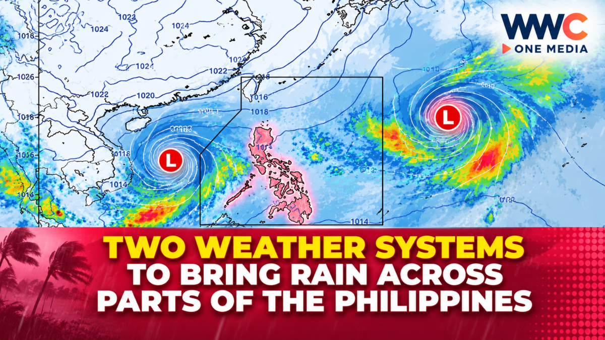
MANILA, Philippines — Two weather systems are expected to bring rain to several parts of the Philippines, with the Intertropical Convergence Zone (ITCZ) affecting much of the Visayas, Mindanao and Palawan while northeasterly winds bring wetter conditions to parts of northern Luzon.
The Philippine Atmospheric, Geophysical and Astronomical Services Administration (PAGASA) said on Wednesday, Oct. 7, that the ITCZ was affecting Visayas, Mindanao and Palawan, where cloudy skies, scattered rain and thunderstorms were expected.
Meanwhile, Batanes and Cagayan were experiencing cloudy skies with rain due to the northeasterly windflow.
The weather systems come as the country enters another period of unsettled conditions, with several areas facing the possibility of moderate to occasionally heavy rain.
ITCZ brings rain to Visayas and Mindanao
The ITCZ is expected to be the main driver of rainfall over the central and southern Philippines.
PAGASA forecast cloudy skies with scattered rains and thunderstorms over Visayas, Mindanao and Palawan.
The agency warned that moderate to at times heavy rainfall could trigger flash floods and landslides, particularly in areas already vulnerable to flooding or where rain persists for several hours.
Several major cities in the Visayas and Mindanao were also forecast to experience wet conditions.
For example, PAGASA’s extended outlook showed a 60% chance of rain in Metro Cebu on Wednesday, with similar rainy conditions expected over the following days.
Metro Davao was likewise forecast to have cloudy skies with rain showers and thunderstorms, with a 60% chance of rain on Wednesday and higher chances on Thursday.
Northeasterly winds affect northern Luzon
While the ITCZ is bringing rain farther south, northeasterly windflow is affecting northern Luzon.
PAGASA said Batanes and Cagayan would experience cloudy skies with rain on Wednesday, with moderate to at times heavy rainfall also posing a risk of flash floods and landslides.
The northeasterly winds are also expected to influence weather conditions in other parts of Luzon as the week progresses.
PAGASA’s weekly outlook said that on Oct. 8 and 9, the northeasterly windflow could bring cloudy skies with light rains over Cagayan Valley, Aurora and Quezon, while the Ilocos Region and Cordillera Administrative Region could experience partly cloudy to cloudy skies with isolated light rains.
Metro Manila may still see isolated thunderstorms
Metro Manila is not currently under the main area of influence of the ITCZ, but residents should still expect occasional rain.
PAGASA forecast partly cloudy to cloudy skies with isolated rain showers or thunderstorms over the capital region on Wednesday.
The agency said severe thunderstorms could still produce localized flooding or landslides.
PAGASA’s extended forecast puts Metro Manila temperatures at around 24°C to 32°C on Wednesday.
Rain chances are expected to increase on Thursday, when the capital could see cloudy skies with rain showers or thunderstorms and a higher chance of precipitation.
Eastern and southern areas face continued wet weather
The wet conditions are expected to persist in parts of the country over the next several days.
PAGASA’s weekly outlook indicates that another weather disturbance outside the Philippine Area of Responsibility could influence the country from Oct. 8 to 9, with its trough potentially bringing scattered rains and thunderstorms over Eastern Visayas and most of Mindanao.
Cities such as Legazpi, Cebu and Davao are among areas expected to experience recurring rain showers and thunderstorms through the coming days.
In Metro Cebu, PAGASA’s five-day outlook showed a 60% chance of rain on Wednesday, Thursday and Friday, while Metro Davao was forecast to have rain chances of 60% on Wednesday, 70% on Thursday and 60% on Friday.
Flash floods and landslides remain a concern
PAGASA is urging the public to remain alert in areas vulnerable to flooding and landslides, especially when thunderstorms produce heavy rainfall over a short period.
The risk is particularly important in mountainous and low-lying communities, where saturated ground and waterways can respond quickly to intense rainfall.
Motorists should also exercise caution during heavy downpours because reduced visibility and flooded roads can make travel more difficult.
Coastal waters could become rough in northern Luzon
The weather systems are also affecting marine conditions.
PAGASA forecast moderate to strong winds over the northern and eastern sections of Northern Luzon, with coastal waters expected to be moderate to rough, with wave heights of about 2.5 to 4 metres.
The rest of Luzon was expected to have light to moderate winds and slight to moderate seas, while Visayas and Mindanao were forecast to experience light to moderate winds with generally slight to moderate coastal conditions.
The conditions could affect small fishing boats and other small sea vessels operating in exposed waters.
Rainy conditions likely to continue
The latest forecast suggests that the Philippines will continue to experience a mix of rainy and unsettled weather as the ITCZ and northeasterly winds influence different parts of the country.
For Wednesday, the main areas of concern are Visayas, Mindanao, Palawan, Batanes and Cagayan, while the rest of the country may experience isolated rain showers or thunderstorms.
The weather pattern is expected to evolve over the coming days, with another disturbance potentially increasing rainfall in Eastern Visayas and Mindanao from Thursday.
Residents are advised to monitor PAGASA’s latest weather bulletins, particularly those living in flood- and landslide-prone areas.
For now, the message from weather authorities is straightforward: rain will remain part of the forecast across several parts of the Philippines, and localized heavy downpours could still bring sudden flooding and landslides.