
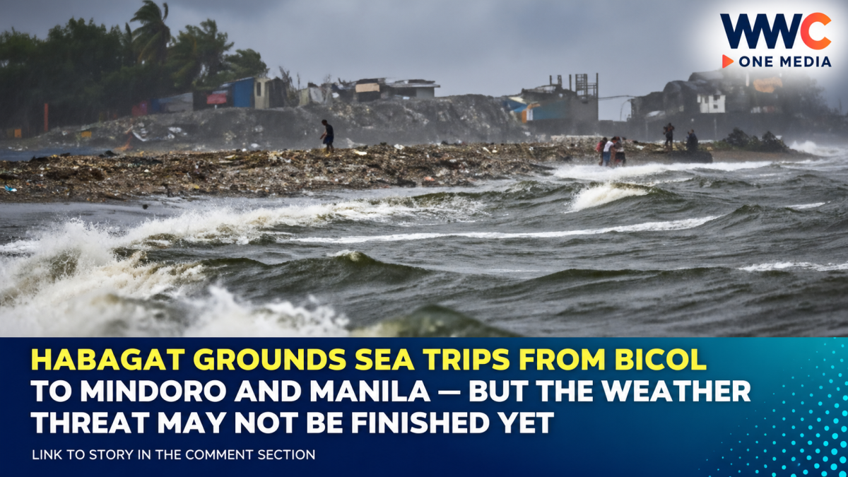
MANILA, Philippines — Travelers heading across some of the Philippines’ busiest inter-island routes faced fresh disruption Sunday as the Southwest Monsoon, or Habagat, forced vessels to remain in port across parts of Luzon and Bicol.
The Philippine Ports Authority released an updated list of canceled sea trips as of 12 noon on September 6, 2026, covering routes connecting Masbate, Bicol, Mindoro, Batangas, Palawan and Manila.
The suspensions came as persistent monsoon rains continued affecting large portions of Luzon and the Visayas, with PAGASA warning of possible flash floods and landslides in areas experiencing moderate to heavy rainfall.
But passengers should understand one crucial detail:
PPA is reporting the cancellations—not directly ordering them.
According to the authority, Philippine Coast Guard no-sail advisories automatically stop affected vessels from departing when maritime conditions become unsafe. Shipping companies may also suspend trips under the conditions of their licenses.
These Trips Were Canceled as of Noon Sunday
PPA’s September 6 advisory listed the following affected services.
Bicol
At TMO Pio Duran, CAVS Seatransport Services suspended service between Baseport Masbate and Pio Duran Port, including the return route.
At TMO Camarines, Starhorse Shipping Lines suspended trips between San Pascual, Masbate and Pasacao Port, Camarines Sur, in both directions.
At Virac Port in Catanduanes, Cardinal Silangan Shipping Corp. canceled service between Virac and Tabaco.
The corresponding Tabaco-to-Virac service was also listed as canceled.
Masbate
At Baseport Masbate, Montenegro Shipping Lines suspended all fastcraft trips from Masbate City to Pilar, Sorsogon.
At TMO Burias, Starhorse Shipping Lines suspended the San Pascual, Masbate–San Andres, Quezon service.
Mindoro
At Puerto Galera, the MV City of Bacolod departures scheduled for 7:15 a.m. and 12:30 p.m. to Batangas were canceled.
The MV Pterippus 1, scheduled to depart Puerto Galera for Batangas at 6 a.m., was also listed among the canceled services.
That 12:30 p.m. time is worth noting because some September 5 reports listed a different afternoon schedule for the same vessel. For the September 6 advisory, the Bombo/PPA list specifically states 12:30 p.m.
Metro Manila to Palawan
At TMO Pasig/Port of Pasig River, the June Aster of Atienza Interisland Ferries was prevented from operating its Manila service to Coron, El Nido and Liminangcong.
The Cancellations Have Continued for a Second Day
Sunday’s disruption was not an isolated event.
A day earlier, PPA had also reported cancellations involving Manila, Mindoro and Batangas.
On September 5, GMA News reported that the June Aster and October Lavender services out of Manila were canceled, along with the MV City of Bacolod from Puerto Galera and SuperCat fastcraft trips between Batangas and Calapan.
That shows how quickly schedules can change from one advisory to another.
Some services listed Saturday disappeared from Sunday’s noon cancellation list, while additional routes in Bicol and Masbate appeared.
For passengers, that means yesterday’s cancellation—or resumption—is not necessarily a reliable guide to today’s sailing status.
Habagat Is Still Driving Unsettled Weather
The maritime disruption comes as the Southwest Monsoon continues to dominate weather conditions over Luzon and parts of the Visayas.
PAGASA’s early Sunday forecast placed Zambales, Bataan, Cavite, Batangas and Occidental Mindoro under occasional rains.
Metro Manila, the Ilocos Region, Cordillera, Western Visayas, much of Mimaropa, Rizal, Laguna and Antique were expected to experience scattered rain and thunderstorms.
The weather bureau warned that flash floods and landslides remain possible, particularly where rainfall becomes moderate to heavy.
That same forecast is particularly relevant to the canceled Puerto Galera-Batangas trips because both Batangas and Occidental Mindoro were specifically identified among areas experiencing monsoon-driven rainfall.
Rougher Waters Are Part of the Risk
Heavy rain alone is not what determines whether a vessel can safely sail.
Wind and wave conditions matter just as much.
PAGASA forecast moderate to rough coastal waters of about 1.5 to 3.4 meters in Extreme Northern Luzon early Sunday.
For the rest of Luzon, waves were forecast at approximately 0.6 to 2.5 meters, while the rest of the country could experience seas of around 0.6 to 2.1 meters.
Local conditions can still be worse than broad regional forecasts, especially around exposed channels and during thunderstorms.
That is why Coast Guard restrictions may affect a specific port or route even when weather at the passenger’s point of origin appears relatively calm.
Pilandok Could Continue Strengthening the Monsoon
Adding uncertainty to the outlook is Tropical Storm Krovanh, formerly Pilandok.
Early Sunday, PAGASA placed the storm about 875 kilometers northeast of Extreme Northern Luzon, carrying maximum sustained winds of 65 km/h and gusts reaching 80 km/h.
The previous afternoon, PAGASA said Krovanh could reenter the Philippine Area of Responsibility on Sunday and regain the local name Pilandok.
Importantly, forecasters said a Philippine landfall remained unlikely.
But the cyclone could continue enhancing the Habagat over Luzon and the Visayas, meaning its indirect effect may matter more to many Filipinos than the storm’s actual track.
That distinction is essential.
Pilandok does not have to cross the Philippine coastline to worsen rainfall, winds or sea conditions elsewhere in the country.
This Weather Pattern Has Already Caused Much Bigger Damage
The sea-trip cancellations are only one part of a much larger weather emergency affecting the Philippines.
NDRRMC figures reported Sunday showed 43 people had been reported dead amid the combined effects of the Southwest Monsoon and tropical cyclones Luis, Maymay, Neneng and Pilandok.
Most reported deaths were linked to landslides and drowning, while other cases involved electrocution and falling trees.
Separate reporting based on NDRRMC data said approximately 10.2 million people, or 2.9 million families, had been affected across the Ilocos Region, Central Luzon, CALABARZON, Mimaropa, Bicol, Metro Manila and Western Visayas.
More than 62,000 people were staying in evacuation centers, according to the same report.
Those figures refer to the combined effects of several cyclones and the Habagat—not Sunday’s ferry cancellations alone.
That distinction matters because it would be inaccurate to imply that the canceled voyages themselves resulted from one single storm or caused the broader casualty toll.
Why PPA Says It Isn’t the Agency Canceling the Trips
There is often confusion when a “PPA canceled trips” headline appears.
PPA operates and manages much of the country’s port system, but maritime safety restrictions fall principally under the Philippine Coast Guard.
PPA explained that when the Coast Guard imposes a no-sail policy because of unsafe weather, affected trips are automatically canceled.
Shipping companies can independently suspend their own services as long as they comply with the conditions governing their franchises or certificates.
This means three different things can happen:
A port can remain open.
A passenger terminal can continue operating.
But a particular vessel may still be prohibited from leaving.
For travelers, what matters most is the status of the specific vessel and route, not merely whether the port itself is open.
Don’t Assume a Canceled Trip Will Resume at the Next Scheduled Departure
One of the easiest mistakes passengers can make during prolonged Habagat conditions is assuming that a canceled morning voyage automatically means the afternoon sailing will proceed.
That is not guaranteed.
No-sail restrictions can remain in force until sea conditions improve, while shipping companies may need additional time to reposition vessels or reorganize disrupted schedules.
Previous PPA advisories have specifically urged travelers to coordinate with their shipping companies and port authorities before heading to terminals when weather disruptions are occurring.
That advice is particularly important during the current weather pattern because Sunday’s list had already changed significantly from the routes announced the previous day.
The Biggest Risk May Be What Happens Next
As of Sunday’s noon advisory, the most visible disruption was concentrated around several routes in Bicol, Masbate, Mindoro and Manila.
But the weather system driving those cancellations was still active.
Habagat rains remained over large parts of Luzon and the Visayas.
PAGASA was still monitoring a tropical storm near the Philippine Area of Responsibility.
And the sea-trip list had already changed repeatedly within the previous 48 hours.
That means passengers with travel plans should treat PPA’s noon list as exactly what it is:
a snapshot of conditions at noon—not a guarantee for the rest of September 6 or the following day.
For people trying to reach Palawan, Mindoro, Masbate, Bicol or Batangas, the most important update may therefore be the next one.
The ships were kept at the docks because of today’s conditions. Whether they sail next will depend on what the Habagat does next.
WWC ONE MEDIA M.J.E




Leave a Reply