
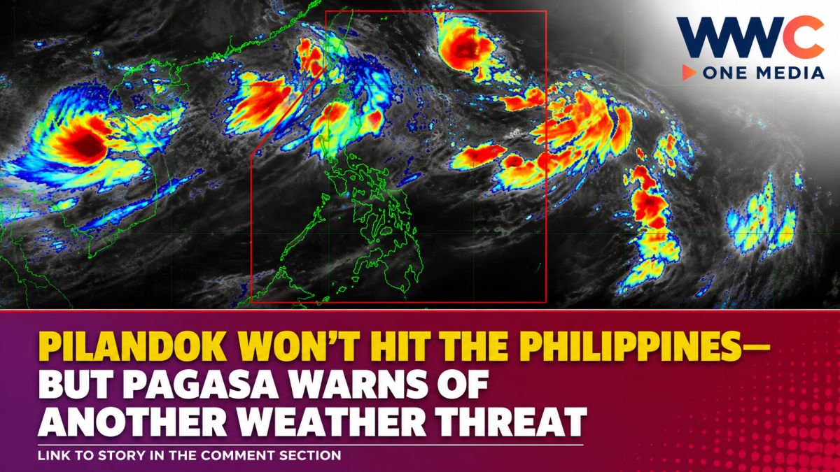
MANILA, Philippines — Tropical Depression Pilandok is not expected to directly affect the Philippines, but Filipinos are not entirely in the clear as the weather system continues to enhance the southwest monsoon or Habagat, bringing potentially heavy rains, strong winds and rough seas to several parts of the country.
According to the Philippine Atmospheric, Geophysical and Astronomical Services Administration (PAGASA), Pilandok was estimated at 1,050 kilometers east of Extreme Northern Luzon as of 3 a.m. Tuesday, September 1.
The tropical depression was carrying maximum sustained winds of 55 kilometers per hour (kph) near its center, with gustiness of up to 70 kph, while moving west-northwestward at 10 kph. No tropical cyclone wind signal was raised over any part of the Philippines.
PAGASA said the cyclone is unlikely to make landfall in the country and is expected to remain far from the Philippine landmass. It may turn east-northeastward and then northward before eventually moving north-northwestward and leaving the Philippine Area of Responsibility (PAR) by Wednesday evening or Thursday morning.
The weather bureau also said Pilandok could intensify into a tropical storm within the next 12 hours as it moves over the Philippine Sea toward southern Japan.
Habagat remains the bigger concern
While Pilandok is staying far from the country’s landmass, its interaction with the southwest monsoon is helping keep the Habagat active over Luzon and the western section of the Visayas.
PAGASA’s rainfall outlook for Tuesday placed several provinces under a 50 to 100 millimeter rainfall forecast, including Ilocos Norte, Ilocos Sur, La Union, Pangasinan, Batanes, Abra, Benguet, Zambales and Bataan.
The weather bureau warned that rainfall could be higher in mountainous and elevated areas, while previously saturated areas may experience worse impacts.
The combination of persistent rain and saturated ground raises the possibility of flash floods and landslides, particularly in vulnerable communities.
Earlier forecasts also showed periods of heavy to intense rain over portions of Northern and Central Luzon as the enhanced Habagat persisted. PAGASA warned that flooding could become more likely in urbanized, low-lying and riverside areas.
Strong winds and dangerous seas also possible
The threat is not limited to rainfall.
PAGASA said the Habagat could generate strong to gale-force winds across most of Luzon and the Visayas, as well as several provinces in Mindanao, through Thursday, September 3. Coastal and upland areas exposed to the monsoon winds could be particularly affected.
A Gale Warning is also in effect over the northern and western seaboards of Northern Luzon.
Sea conditions could become particularly dangerous, with waves reaching as high as 5 meters along portions of the western seaboard of the Babuyan Islands and Ilocos Norte. Waves of up to 4.5 meters are also possible in parts of Batanes, Pangasinan, Ilocos Sur and northern La Union.
PAGASA advised mariners to exercise extreme caution and said sea travel is risky under these conditions. Small boats and motorbancas are likewise advised not to venture into affected waters.
More than Pilandok is being monitored
Pilandok is also not the only weather disturbance being watched by PAGASA.
The weather bureau is monitoring other tropical systems outside the Philippine Area of Responsibility, including Tropical Storm Saudel, formerly known locally as Obet, and another tropical depression west-northwest of Batanes.
Despite the number of systems being monitored, PAGASA’s current forecast indicates that Pilandok itself poses a low direct landfall threat to the Philippines.
The immediate concern for residents, however, remains the enhanced Habagat.
For communities in western and northern Luzon and the western Visayas, the absence of a direct landfall does not necessarily mean an absence of danger. Persistent monsoon rains can still trigger flooding, landslides and hazardous sea conditions even when the tropical cyclone remains hundreds of kilometers offshore.
For now, PAGASA continues to urge residents in affected areas to monitor official weather bulletins and local disaster risk reduction advisories, particularly those in flood- and landslide-prone communities.




Leave a Reply