
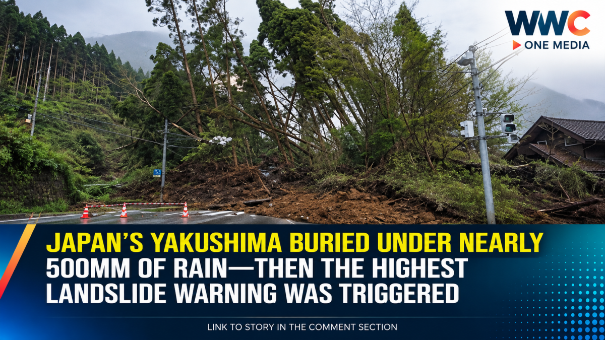
TOKYO — A powerful combination of tropical storm moisture and a stalled weather front has unleashed extraordinary rainfall across southwestern Japan, prompting authorities to issue the country’s highest landslide emergency warning for Yakushima Town in Kagoshima Prefecture.
The Japan Meteorological Agency (JMA) issued the Level 5 emergency landslide warning at 5:10 a.m. on Saturday, Sept. 5, warning that a disaster may already have occurred and urging people in affected areas to immediately secure their safety.
The warning was focused on Yakushima Town, where rainfall had reached exceptional levels.
At the Onoaida observation point, 24-hour rainfall reached 490.5 millimeters by 5:30 a.m., setting a new record for the location, according to reports citing JMA data.
That means nearly half a meter of rain fell in just 24 hours.
Two rounds of rain bands intensified the danger
The extreme rainfall was not a single short downpour.
A linear rain band, known in Japan as senjo kosuitai, developed over the Tanegashima-Yakushima area on Friday night and returned again during the early hours of Saturday.
The JMA issued information about the second rain band at around 2:48 a.m., warning that extremely heavy rain was continuing over the same area and that the risk of landslides, flooding and river overflows was rapidly increasing.
Television Asahi reported that Yakushima recorded more than 120mm of rain in one hour during the overnight period.
Level 5 means the danger is already critical
Japan’s Level 5 warning is not simply an indication that bad weather is coming.
It represents an extreme, potentially life-threatening situation in which a disaster may already be occurring or imminent.
The JMA urged residents to avoid dangerous slopes and waterways and to secure their safety immediately. If leaving a building is too dangerous, authorities have advised people to move to a safer part of a sturdy building, preferably away from cliffs and other exposed areas.
The warning is particularly serious on Yakushima because of the island’s mountainous terrain.
Rivers were also rising
Local conditions were deteriorating as the rain continued.
Television Asahi reported from Yakushima that the Miyanoura River had risen significantly, with water approaching the underside of a bridge. Local authorities were broadcasting warnings urging residents to take maximum precautions.
At the time of that report, there were no major casualties or widespread major damage confirmed, but officials stressed that the situation remained dangerous.
That distinction is important: the absence of confirmed major damage does not mean the emergency has passed.
More than 34,000 people under evacuation orders
The severe weather also triggered evacuation measures elsewhere in Kagoshima Prefecture.
Television Asahi reported that more than 34,000 people across five municipalities had been placed under Level 4 evacuation orders, covering areas including Tanegashima, Yakushima and Toshima Village.
Authorities have repeatedly warned residents not to wait until the highest-level warning is issued before moving to safety.
In other words, Level 5 is not the moment to start planning an evacuation—it is the point at which people should already be taking immediate protective action.
Typhoon Krovanh is part of the weather setup
The torrential rainfall is linked to Typhoon No. 24, Krovanh, together with a weather front affecting Japan.
The storm has been drawing warm, moisture-rich air toward southern Japan. That moisture has helped fuel powerful rain clouds over Kagoshima and neighboring areas.
Weathernews reported that the combination of the storm’s moisture and the seasonal front was expected to keep parts of southern Kyushu at risk of additional heavy rain.
The danger therefore extends beyond Yakushima.
Southern Japan remains on alert
Forecasts cited by Japanese weather authorities indicate that heavy rainfall could continue across parts of Kyushu, Shikoku and other areas of western and eastern Japan.
One forecast cited by Kyodo-based reporting put rainfall through Sunday morning at up to 200mm in southern Kyushu, with additional heavy rain possible across several other regions.
The concern is not only the amount of rain falling at any particular moment.
After prolonged rainfall, the ground can become saturated, increasing the likelihood of landslides, mudflows and slope collapses—even after the rain temporarily weakens.
Weathernews specifically warned that the danger could remain elevated even after the heaviest rainfall passes.
Yakushima’s record rainfall raises the stakes
The latest figures underscore just how unusual the rainfall has become.
At Onoaida, the 490.5mm 24-hour total broke the site’s previous rainfall record, according to reporting based on JMA observations. Another Yakushima observation point recorded 429.5mm over 24 hours by 5:10 a.m., also reaching a notable September record for that station.
The JMA has described the conditions as exceptionally dangerous and warned that landslides could already be occurring in areas where the highest alert applies.
The threat may not end when the rain stops
One of the most dangerous aspects of this type of disaster is that the worst consequences can come after the peak rainfall.
Water continues to move through already saturated soil, while slopes weakened by prolonged rain can collapse suddenly.
That is why authorities are continuing to warn about landslides, flooding and swollen rivers even as rainfall intensity changes.
Forecasts also indicate another period of potentially heavy rainfall could develop over parts of Japan in the following days as the tropical system and frontal boundary interact.
WWC ONE MEDIA M.J.E




Leave a Reply