
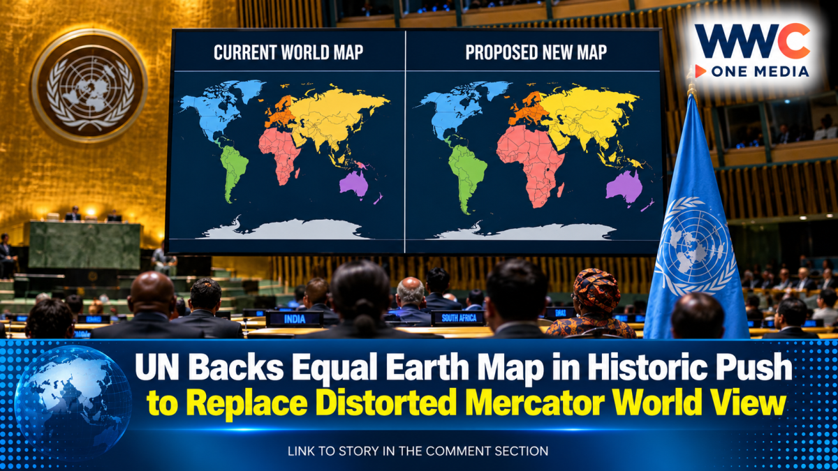
UNITED NATIONS — The United Nations General Assembly has endorsed a major shift in how the world could be represented on maps, backing the Equal Earth projection in a move aimed at correcting the dramatic distortions created by the centuries-old Mercator map.
The resolution, passed on Friday with 164 member states voting in favor, encourages governments and institutions around the world to adopt the Equal Earth projection, which more accurately represents the relative sizes of continents.
Only the United States voted against the measure, while Serbia, Estonia, Georgia, Lithuania, Moldova and Ukraine abstained.
The initiative was sponsored by Togo and supported by members of the African Union after a campaign led by African countries and advocacy groups calling for maps that more accurately represent the size of Africa and other regions of the Global South.
Africa Is Not the Same Size as Greenland
One of the clearest examples of the Mercator projection’s distortion is the way it represents Africa and Greenland.
On many traditional Mercator maps, the two landmasses appear to be roughly similar in size.
In reality, Africa is about 14 times larger than Greenland.
The Mercator projection also enlarges regions closer to the poles, including North America and parts of Europe, while making areas closer to the equator, including Africa and South America, appear significantly smaller than they actually are.
The Equal Earth projection was designed to address that problem by presenting continents in more accurate proportions while still creating a visually recognizable world map.
For supporters of the change, the issue is about far more than geography.
It is about how people see the world.
A Map Can Shape How the World Is Understood
“Maps shape our understanding of the world,” Togolese Minister of Foreign Affairs Robert Dussey said before the vote.
For centuries, the Mercator projection has appeared in classrooms, textbooks, newsrooms and government institutions around the world.
Its influence has been so widespread that generations of people have grown up with a distorted visual understanding of the relative size of countries and continents.
Supporters of the Equal Earth campaign argue that repeatedly seeing Africa, South America and other regions represented as smaller than they really are can influence how people unconsciously understand their importance and place in the world.
Africa No Filter, one of the leading groups behind the campaign, called for more accurate maps to be used across schools, businesses, news organizations and digital platforms.
The campaign argues that correcting the map will not change geography—but it could change perceptions.
The Mercator Map Was Designed for Navigation
The Mercator projection was never originally intended to provide a perfectly accurate representation of the size of continents.
It was created in the 16th century by Flemish cartographer Gerardus Mercator to help sailors navigate the world’s oceans.
The projection became particularly useful for maritime navigation because it allowed navigators to plot straight-line courses.
However, that advantage came with a major trade-off.
To maintain those navigational properties on a flat map, the projection increasingly enlarges areas closer to the poles.
As a result, Greenland appears enormous, while Africa and South America appear much smaller than they truly are.
Geographers have long emphasized that every flat map projection involves some form of distortion because it is impossible to perfectly represent a spherical Earth on a flat surface.
The question is not whether a map contains distortion.
The question is what the map chooses to distort.
Equal Earth Offers a Different Perspective
The Equal Earth projection was introduced in 2018 as a modern alternative designed to preserve the relative size of continents and countries more accurately.
Its distinctive curved appearance follows the shape of the Earth while avoiding the extreme enlargement of northern regions seen on the Mercator projection.
Under the UN resolution, governments and institutions are encouraged to consider using the Equal Earth projection.
However, the resolution does not ban the Mercator map or impose a mandatory replacement.
The Mercator projection can continue to be used, particularly for its traditional navigational purposes.
The UN action is instead intended to encourage wider use of maps that provide a more accurate visual representation of the world’s landmasses.
A Historic Win for African Campaigners
The vote represents a major victory for African governments and advocacy groups that have spent years challenging the continued dominance of the Mercator map.
Supporters argue that the widespread use of distorted maps has helped reinforce outdated perceptions of the world’s geography.
French Foreign Minister Jean-Noel Barrot said after the vote that changing a map does not change reality, but correcting a distorted representation is an important act in itself.
The message behind the campaign is straightforward:
Africa should look as large on a map as it actually is.
South America should not be visually diminished.
And the world’s most widely used maps should not unintentionally give people a misleading impression of the planet.
Will Schools and Governments Change Their Maps?
The UN resolution could increase pressure on governments, schools, publishers and digital platforms to reconsider which map projections they use.
For decades, the Mercator map has been the default image of the world in many classrooms.
Changing that could take years.
Textbooks would need to be updated.
Digital platforms could need to reconsider their map displays.
Government institutions and news organizations could also face questions about whether their maps accurately represent the relative size of countries and continents.
The change could eventually affect millions of students who may grow up seeing the world differently from previous generations.
The World Has Not Changed—But the Map Might
The UN vote will not make Africa larger.
It has always been that large.
It will not make Greenland smaller.
It has always been that small compared with Africa.
What could change is the image of the world that billions of people see.
For more than 400 years, the Mercator projection has shaped humanity’s visual understanding of the planet.
Now, the United Nations has signaled that it may be time for a different view.
The world itself has not changed—but after centuries of looking at a distorted map, the way the world sees itself may finally be starting to change.
WWC ONE MEDIA J.M.D



Leave a Reply