
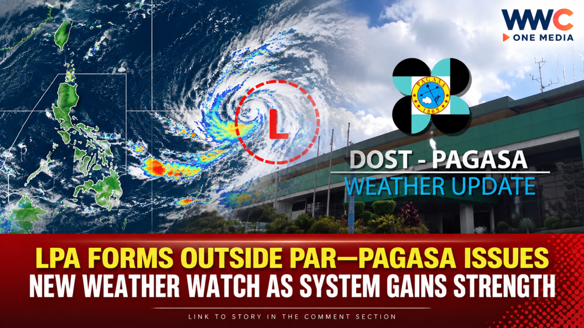
A new low-pressure area (LPA) has formed outside the Philippine Area of Responsibility (PAR), prompting the Philippine Atmospheric, Geophysical and Astronomical Services Administration (PAGASA) to closely monitor its development.
The weather disturbance, identified as LPA 09d, was located about 3,265 kilometers east of Eastern Visayas as of 2 a.m. Monday, according to PAGASA’s latest weather information reported by GMA News.
While the system remains far from Philippine territory, PAGASA said it has a medium chance of developing into a tropical depression within the next 24 hours.
That development is worth watching, particularly as the country continues to experience changing weather conditions associated with seasonal weather systems.
LPA not expected to directly affect the Philippines for now
Despite its potential to intensify, the LPA’s current position means it is not expected to directly affect the Philippines at this time.
PAGASA’s forecast for Monday indicates that Metro Manila and the rest of the country will generally experience partly cloudy to cloudy skies with isolated rain showers or thunderstorms caused by localized thunderstorms.
In Batanes and the Babuyan Islands, meanwhile, partly cloudy to cloudy conditions with isolated rain showers or thunderstorms are expected due to the easterlies. PAGASA warned that severe thunderstorms could still trigger flash floods or landslides in vulnerable areas.
Why Filipinos should still keep watching
The latest development comes after PAGASA had been monitoring other low-pressure areas outside the PAR in recent days.
On September 11, PAGASA was tracking two LPAs outside the PAR. One, located west of southwestern Luzon, had a medium chance of developing into a tropical depression, while another system east of Eastern Visayas was considered unlikely to intensify at the time.
PAGASA’s weekly outlook also indicated that weather conditions would remain changeable through the middle of September, with possible low-pressure-area activity and thunderstorms affecting various parts of the country.
This means that the absence of an immediate threat from LPA 09d does not mean the country is completely free from rain-related hazards. Localized thunderstorms can still produce sudden heavy rain, flooding and landslides, particularly in areas prone to these hazards.
Weather system to watch in the coming days
For now, the key factor is whether LPA 09d will continue to strengthen and what direction it will take.
PAGASA’s latest information gives the disturbance a medium chance of becoming a tropical depression within 24 hours, so its movement and intensity will need to be monitored through succeeding weather bulletins.
The latest situation also highlights why Filipinos should continue checking official PAGASA advisories rather than relying solely on the current location of a weather disturbance. A system that is initially far outside the PAR can change in strength and movement, potentially altering its eventual impact.
For now, however, LPA 09d remains outside the PAR and is not being identified as an immediate direct threat to the Philippines.



Leave a Reply