
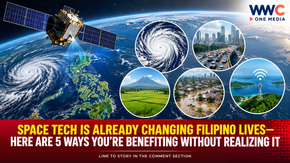
Space technology may sound like something reserved for astronauts, rockets and distant planets—but for Filipinos, its impact is already happening much closer to home.
From tracking powerful typhoons and mapping flooded communities to helping people navigate traffic and giving farmers better information about their crops, satellites have become an increasingly important part of everyday life in the Philippines.
And as the country expands its own satellite capabilities, that role is expected to become even bigger.
The Philippine Space Agency (PhilSA) has emphasized that space-derived data can support disaster response, agriculture, environmental monitoring, infrastructure planning and national development.
Here are five ways space technology is already affecting Filipinos—and why its importance is growing.
1. Satellites help Filipinos prepare for typhoons
One of the most obvious benefits of space technology is weather monitoring.
The Philippines is one of the world’s most disaster-prone countries, with tropical cyclones regularly threatening communities across the archipelago. Satellite observations give meteorologists a much broader view of weather systems developing over the oceans.
PAGASA uses imagery from Japan’s Himawari-8 and Himawari-9 weather satellites for real-time weather forecasting, tropical cyclone analysis and research. The system can produce imagery at intervals of about 10 minutes, providing meteorologists with a continuous view of developing weather disturbances.
But satellites aren’t useful only before a storm.
They can also help authorities determine which communities and infrastructure have been affected after a disaster.
In July 2026, for example, PhilSA used Sentinel-1 synthetic aperture radar (SAR) imagery combined with artificial intelligence to map flooding in several regions following Typhoon Inday and enhanced southwest monsoon conditions. SAR is particularly valuable because it can detect areas through cloud cover and even operate at night.
That means satellite data can help responders see the scale of a disaster from above—potentially allowing resources to be directed toward areas that need them most.
2. Your navigation apps are powered by space
Ever wondered how your phone knows where you are?
Global navigation satellite systems—or GNSS—send signals from satellites orbiting Earth to compatible devices on the ground.
The technology is behind many location-based services people now take for granted, including navigation and mapping applications.
For Filipino motorists dealing with Metro Manila’s notorious congestion, satellite-based positioning helps navigation apps determine a vehicle’s location and provide route information.
But satellites can do more than simply tell you where you are.
PhilSA has noted that satellite technology can help cities monitor traffic congestion, air pollution, urban growth and resource availability, giving planners information that can support better decisions about increasingly crowded urban areas.
The country’s planned MULA satellite program could further expand the use of Earth-observation data, including applications related to traffic conditions and monitoring Philippine territory.
3. Farmers can use satellites to see what is happening on the ground
Space technology is also moving into Philippine agriculture.
Satellite imagery can provide information about crops and farmland across large areas—something that would be difficult, expensive and time-consuming to accomplish through ground surveys alone.
PhilSA and the Department of Agriculture’s Bureau of Agricultural and Fisheries Engineering have already worked together on DigitalAgri, using satellite imagery to monitor farm-to-market roads and agricultural commodities, including corn and onions.
The technology can help government agencies develop more accurate maps of agricultural areas and identify where interventions may be needed.
The Department of Agriculture and Philippine Statistics Authority have also explored using satellite imagery and artificial intelligence for agricultural statistics and crop production estimates.
For farmers, the long-term goal is straightforward: better information can mean better decisions about production, logistics and government assistance.
4. Satellites can help authorities map disasters—and even protect food supplies
The value of satellite imagery becomes particularly clear when disasters strike areas that are difficult to access.
PhilSA recently used satellite data to identify potentially affected agricultural areas following ashfall associated with Mayon Volcano.
The agency’s analysis estimated that around 1,039 hectares of rice areas and 191 hectares of other crops were potentially affected by ash deposits. The agency also identified about 158 kilometers of roads within the estimated ash-deposit area.
Satellite imagery can therefore provide authorities with a bird’s-eye view of damage to farms, roads and other areas—information that can complement reports collected by teams on the ground.
Diwata-2, the Philippines’ second Earth-observation microsatellite, has also been used for environmental monitoring and post-disaster assessment. By early 2025, it had captured more than 157,000 satellite images and covered roughly 96.47% of Philippine land area.
This illustrates a major shift for the country: satellites are no longer simply symbols of technological achievement. Their data are increasingly being converted into information that government agencies can actually use.
5. Space technology could keep Filipinos connected when disasters knock out networks
For an archipelago made up of more than 7,000 islands, connectivity is a major challenge—especially when storms damage terrestrial communications infrastructure.
That is where satellite communications could become increasingly important.
In a recent field test, PLDT-Smart and Lynk Global demonstrated direct-to-device satellite communications in parts of Ilocos Norte where terrestrial mobile coverage can be limited. Engineers successfully exchanged text messages between smartphones in Ilocos Norte and Metro Manila and accessed public information websites.
The technology is designed to complement—not necessarily replace—traditional mobile networks.
That distinction matters during disasters.
If a typhoon, earthquake or other emergency damages towers or other terrestrial infrastructure, satellite connectivity could provide another layer of communication for people in affected or geographically isolated communities.
The Philippine government is also pursuing a proposed sovereign geostationary telecommunications satellite program, which officials say could strengthen connectivity in geographically isolated and disadvantaged areas while supporting critical government operations and disaster resilience.
The Philippines’ space program is entering a new phase
The country’s space ambitions are also moving beyond individual satellites.
The Philippine Space Agency says the Multispectral Unit for Land Assessment (MULA) is now fully built and undergoing space-environment testing, with launch targeted as early as April 2027, according to a 2026 Inquirer report citing PhilSA.
More significantly, the Philippine Space Council has approved plans for a MULA satellite constellation, which would eventually involve additional satellites developed and integrated domestically.
The objective is to increase the frequency with which the Philippines can observe its territory while building local expertise and capability in satellite manufacturing.
PhilSA’s longer-term plans show how dramatically the country’s relationship with space technology has changed.
The agency says the experience gained from Diwata-1 and Diwata-2 helped Filipino engineers and scientists develop capabilities that can now be applied to more advanced national space programs.
Space is no longer “somewhere up there”
For ordinary Filipinos, the most important development may not be the launch of another satellite itself.
It is what happens after the satellite starts sending information back to Earth.
That data can help determine where floods are spreading, how crops are performing, where roads may be affected, how cities are changing and how communications can be maintained during emergencies.
In other words, the country’s space program is increasingly becoming an Earth program—one designed to solve problems happening right here at home.
And with the Philippines moving toward larger satellites, satellite constellations and potentially sovereign communications infrastructure, the next major impact of space technology may be something Filipinos use every day without even realizing that it came from orbit.


Leave a Reply