
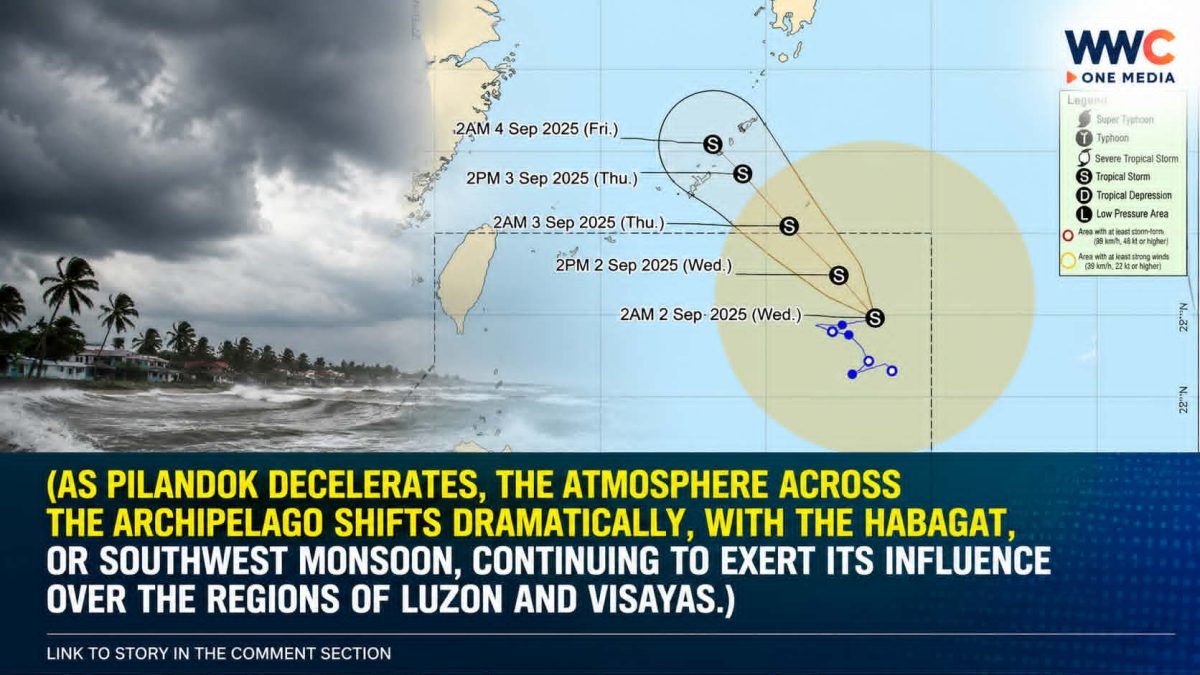
MANILA, Philippines — September 2, 2026. Tropical Storm Pilandok (international name: Krovanh) is moving away from the Philippine landmass, but the Southwest Monsoon, or Habagat, continues to bring heavy rain, strong winds and dangerous seas across parts of the country.
PAGASA reported Wednesday that Pilandok was over the Philippine Sea, far east-northeast of Northern Luzon, with maximum sustained winds of 65 km/h and gustiness of up to 80 km/h. No Tropical Cyclone Wind Signal is currently raised over the country.
But that does not mean the weather threat is over.
PILANDOK IS NOT EXPECTED TO MAKE LANDFALL
Pilandok is forecast to remain far from the Philippine landmass and is expected to leave the Philippine Area of Responsibility (PAR) tonight, September 2, or early Thursday, September 3. PAGASA says the storm is expected to remain a tropical storm while moving northwestward.
Earlier forecasts had Pilandok moving differently over the Philippine Sea, but the latest bulletins show its track evolving as the system moves away.
That is why residents should follow the latest PAGASA bulletins rather than older forecast maps circulating online.
THE BIGGER STORY IS THE HABAGAT
While Pilandok itself is not directly affecting land, its interaction with the broader weather pattern is occurring alongside an active Southwest Monsoon (Habagat).
PAGASA expects strong to gale-force monsoon winds over most of Luzon and the Visayas, as well as several provinces in Mindanao, through September 4.
Rainfall could also remain significant in several areas.
For September 2–3, PAGASA’s forecast calls for 50–100 millimeters of rainfall in parts of Ilocos Norte, Ilocos Sur, La Union, Pangasinan, Abra, Benguet and Zambales.
The rainfall threat then shifts toward parts of Central and Southern Luzon and Western Visayas later in the week.
And there’s another concern: previous rainfall can make the impacts worse.
PAGASA warned that rainfall impacts may be aggravated in areas that have already received significant rain, particularly in mountainous and elevated locations.
SEAS COULD BECOME DANGEROUS
The weather threat isn’t limited to land.
A Gale Warning remains in effect for the northern and western seaboards of Northern Luzon.
PAGASA expects waves reaching up to 5 meters in parts of Batanes, Ilocos Norte, northern Ilocos Sur and the Babuyan Islands. Waves of up to 4.5 meters are possible in parts of La Union, Pangasinan and Ilocos Sur.
That makes sea travel particularly dangerous for small vessels and inexperienced operators.
DON’T BE FOOLED BY PILANDOK’S DISTANCE
This is perhaps the most important message.
A tropical cyclone does not need to make landfall to influence Philippine weather.
In this case, the immediate concern is the Habagat, which can continue producing heavy rain and strong winds even as Pilandok moves farther away.
GMA, Inquirer and the Philippine News Agency all reported that Pilandok remains far from land while the southwest monsoon continues to affect Luzon and the Visayas.
WHAT COMMUNITIES SHOULD WATCH
Residents in affected areas should remain alert for:
- Heavy or prolonged rainfall
- Rapidly rising rivers and streams
- Possible landslides in mountainous areas
- Strong to gale-force winds
- Dangerous waves and coastal conditions
- Thunderstorms and localized flooding
The latest forecast also indicates that rainfall may continue over portions of Luzon and the Visayas through the weekend, with some areas potentially receiving 100–200 mm during later forecast periods.
WWC ONE MEDIA G.A




Leave a Reply