
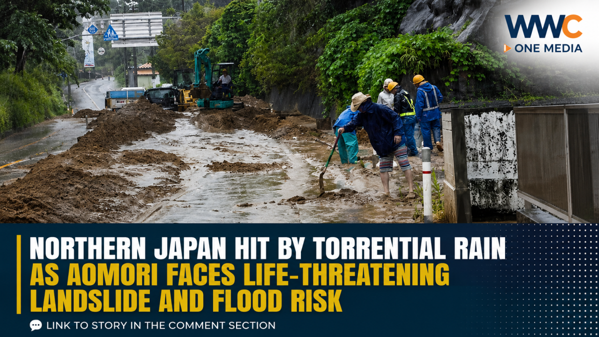
AOMORI, Japan — Torrential rain is hammering northern Japan, with authorities warning of potentially life-threatening landslides, flooding and overflowing rivers, particularly in Aomori Prefecture as a rain front and low-pressure system sweep across the region.
The Japan Meteorological Agency (JMA) has issued Level 4 heavy-rain and landslide warnings in parts of Aomori, urging residents in affected areas to take action to protect themselves rather than wait for conditions to deteriorate.
The situation intensified early Wednesday after powerful rain bands became concentrated over Tsugaru in Aomori.
Aomori sees nearly 90 mm of rain in one hour
Weather News Japan reported that areas around Ajigasawa and Fukaura recorded estimated rainfall of about 90 millimeters in one hour by around 3:20 a.m. Wednesday.
The JMA issued its short-duration heavy-rain disaster information after the extraordinary rainfall, indicating that extremely intense rain capable of triggering disasters was occurring in the area.
Another Weather News report said approximately 150 mm of rain may have fallen in three hours around parts of Tsugaru, sharply increasing the danger of landslides, inundation and river flooding.
Authorities warn the danger isn’t over
The weather threat is not limited to the rainfall already recorded.
Forecasters expect localized heavy rain and thunderstorms to continue across Hokkaido and the Tohoku region, with additional rain potentially worsening already saturated ground and raising the risk of landslides and flooding.
NHK reported that up to 100 mm of additional rain could fall in Tohoku over a 24-hour period through Thursday morning, prompting officials to urge residents to remain vigilant.
Authorities are also warning about lightning, powerful wind gusts, possible tornadoes and hail as unstable weather moves across northern Japan.
The greatest concern is that saturated soil can become unstable rapidly, meaning landslides may occur even after the most intense rainfall has passed.
Tropical Storm Krovanh adds another weather threat
While the northern rain disaster is being driven by a separate weather system, another concern is developing farther south.
Tropical Storm Krovanh was located over the ocean southeast of Okinawa on Wednesday. U.S. National Weather Service advisories placed its maximum sustained winds at about 40 mph (65 km/h), with tropical-storm-force winds extending hundreds of kilometers from its center.
The storm was expected to gradually turn toward the north-northwest, while remaining over the open ocean in the near term, according to the latest U.S. advisory.
NHK reported that Krovanh could approach the Okinawa and Amami areas around Friday, bringing the possibility of stronger winds and rough seas.
Authorities are urging residents and maritime operators in those areas to closely follow updated forecasts.
More rain could spread across Japan
The weather threat could broaden beyond northern Japan.
NHK reported that heavy rain is expected across wider parts of western and eastern Japan from Thursday, meaning residents outside Aomori and Tohoku should also monitor weather and evacuation information.
The combination of a stalled rain front, low-pressure system and additional tropical activity means weather conditions could change quickly.
What residents should watch for
People in affected areas are being urged to pay particular attention to:
- Rapidly rising rivers and overflowing waterways
- Water entering low-lying areas
- Cracks or unusual movement on slopes
- Mud, rocks or water suddenly flowing from hillsides
- Strong wind and lightning
- Tornadoes or hail during severe thunderstorms
- Local evacuation instructions
Japan uses a five-level disaster warning system. Level 4 means residents in areas at risk should take evacuation action rather than wait for a Level 5 emergency.
The bigger picture
This is not simply a rain event.
For communities in mountainous parts of northern Japan, the combination of extreme short-duration rainfall and already-wet ground can quickly turn a weather emergency into a landslide or flash-flood disaster.
And with another tropical storm developing south of the country and broader heavy rain expected later in the week, Japanese authorities are warning residents to stay alert rather than assume the worst weather has already passed.
The immediate danger is in northern Japan — but the next phase of the weather system could affect a much wider part of the country.
WWC ONE MEDIA J.M.D



Leave a Reply