
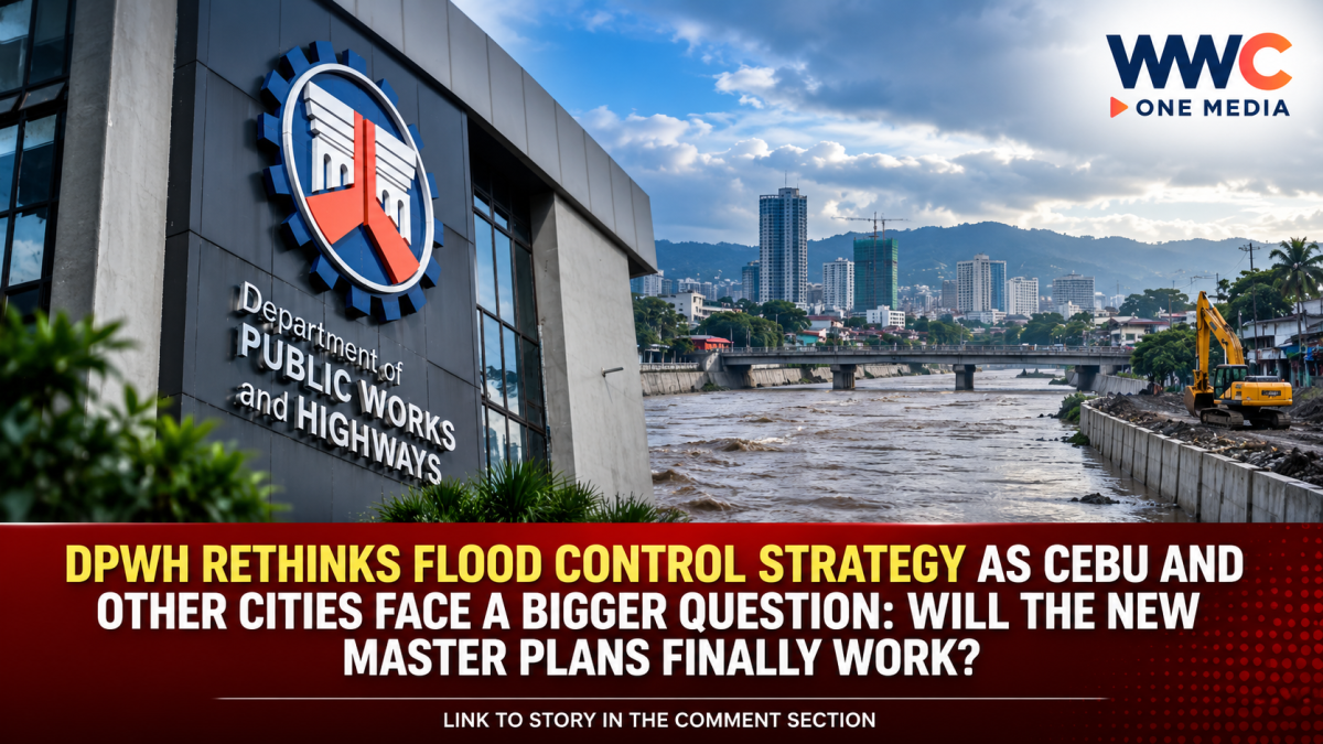
The Department of Public Works and Highways (DPWH) is moving toward a more integrated and science-driven approach to flood control, as the government reassesses how the country should manage increasingly severe flooding.
Instead of treating flooding as a collection of isolated problems requiring individual drainage projects, flood-control planning is increasingly being framed around major river basins, interconnected waterways, upstream runoff and climate risks.
The shift is particularly significant for flood-prone areas such as Metro Cebu, where years of drainage, riverbank protection and other flood-control projects have yet to eliminate recurring flooding.
Recent government statements indicate that the DPWH is now working to update existing flood-management plans and make them more responsive to present-day conditions.
From isolated projects to entire river basins
Palace officials recently said the government intends to pursue a holistic river-basin approach to flood management.
Presidential Communications Office Undersecretary Claire Castro said DPWH plans to address flooding according to major river basins, taking into account the country’s geography and the specific characteristics of flood-prone areas.
This is important because flooding does not stop at city or provincial boundaries.
Rain falling in upland areas can rapidly move downstream through rivers and drainage networks, eventually overwhelming urban communities. A flood-control structure in one location can therefore have limited impact if upstream runoff, downstream capacity and coastal discharge are not considered together.
The government has said the country has flood-control plans covering its 18 major river basins, although several plans have required updating because older studies may no longer adequately reflect current conditions, including the effects of climate change.
As of May 31, 2026, DPWH reportedly had updated master plans and feasibility studies for 16 major basins, while the Cagayan and Pasig-Marikina-Laguna de Bay plans were targeted for completion by the end of the year.
Why Cebu is a critical test case
Metro Cebu provides a striking example of why a broader strategy is being considered.
A recent SunStar Cebu investigation found that more than P43 billion was spent on 1,008 flood-control projects across Cebu from 2016 to 2025.
But despite the scale of spending, the investigation found that many recommendations contained in the 2017 Metro Cebu Flood and Drainage System Master Plan remained largely unfinished or unfunded.
The earlier plan called for interventions that went beyond river walls and seawalls, including detention basins, flood-control dams, watershed rehabilitation, land-use controls and improved coordination across Metro Cebu.
The underlying principle is straightforward: floodwater must be managed before it reaches already-overloaded urban waterways.
SunStar’s reporting also found that a substantial portion of Cebu’s flood-control spending went toward revetments, riverbank protection, seawalls and similar structural works, while comparatively less attention went to upstream retention and watershed-based interventions.
DPWH revives Metro Cebu’s long-delayed master plan
The issue has gained new urgency in Metro Cebu.
In August, SunStar reported that DPWH was reviving the 2017 Metro Cebu flood and drainage master plan, beginning with efforts to connect previously disconnected drainage and flood-control systems.
DPWH Secretary Vince Dizon identified six critical flood areas in Mandaue City, including sections around A.S. Fortuna, A.C. Cortes, U.N. Avenue, M.L. Quezon, LH Prime and the Subangdaku River.
Proposed interventions include drainage connections, a pumping station and floodgate, and a proposed cut-off channel intended to redirect water from the Subangdaku River after right-of-way issues are addressed.
Funding for major components is being considered in upcoming budget proposals, with 2027 identified as an important implementation period.
The government is also looking beyond concrete
The new direction is not necessarily about abandoning traditional flood-control infrastructure.
Rather, the strategy is increasingly about combining structural defenses with retention, watershed management, drainage improvements, nature-based solutions and better data.
The 2026 General Appropriations Act specifically calls for an integrated, environmentally validated and nature-based approach to flood and water-resources management.
It directs DPWH, together with other government agencies, to formulate an Integrated Water Resources and Flood Management Master Plan based on integrated water-resources management and a ridge-to-reef approach.
The framework calls for flood-control, drainage, bridge and road projects to be considered as interconnected systems rather than isolated projects. It also recognizes measures such as wetland and river restoration, watershed rehabilitation, mangrove reforestation and sediment management as part of flood mitigation.
That could represent a significant change in how future flood-control projects are selected and designed.
Why old flood plans may no longer be enough
One of the biggest challenges is that flood risks are changing.
Urban expansion, land-use changes, watershed degradation, drainage constraints and increasingly intense rainfall can alter how water moves through a community.
A plan developed years ago may therefore produce different results when applied to today’s landscape.
The Palace has acknowledged that some existing plans are decades old and may need updating to account for present conditions and climate-change impacts.
This is also why the government is emphasizing updated technical studies, hydrological information and feasibility assessments before committing to major infrastructure.
Metro Manila is testing another piece of the puzzle
The basin-wide strategy is being accompanied by more localized flood-mitigation measures.
In Metro Manila, the Metropolitan Manila Development Authority has identified five priority sites under its Sponge City initiative.
The concept is to temporarily capture and store rainwater in areas where water naturally accumulates, reducing the pressure on drainage systems, rivers and waterways during intense rainfall.
The MMDA has completed a feasibility study covering 39 proposed catchment and nature-based flood-mitigation sites across Metro Manila.
Officials said five priority projects could be completed by June 2027 if funding is secured, while the broader group of projects could potentially be completed later in 2027.
Importantly, MMDA officials have cautioned that the projects will not make Metro Manila completely flood-free. Instead, they are intended to substantially reduce flood risk in vulnerable locations.
The Aquino-Singson plan could also return to the table
Another potentially significant development emerged this week.
Palace officials said Dizon is considering a review of the Aquino-Singson Master Plan, a flood-management plan developed during the administration of former President Benigno Aquino III when Rogelio Singson was public works secretary.
According to the Palace, the older plan could potentially be used alongside DPWH’s plans for the country’s major river basins rather than being treated as an entirely separate strategy.
The possibility of combining lessons from earlier plans with updated basin studies highlights the government’s broader objective: avoid starting from zero while correcting weaknesses in previous approaches.
The bigger question: implementation
For communities that have endured repeated flooding, another master plan alone will not be enough.
Cebu’s experience illustrates the challenge.
Government studies can identify dams, detention basins, watershed interventions and drainage connections, but these recommendations still require funding, land acquisition, coordination, construction and long-term maintenance.
SunStar’s investigation found that several major recommendations from Cebu’s 2017 master plan had remained unfinished despite billions of pesos being spent on flood-control projects.
That creates a difficult test for the government’s new approach.
Can science-based planning finally translate into projects that address the entire flood system—not simply the portion of the river visible from the roadside?
A new flood-control era—or another plan waiting for funding?
The government’s emerging strategy suggests a clear recognition that the Philippines’ flooding problem cannot be solved simply by building more walls, widening individual drainage channels or repeatedly repairing damaged infrastructure.
The direction now points toward river-basin planning, updated climate and rainfall data, upstream retention, nature-based solutions, interconnected drainage systems and stronger coordination among national agencies and local governments.
For Cebu, where billions have already been spent but serious flooding persists, the success of this approach may ultimately be measured not by the number of projects completed—but by whether communities actually experience less frequent, less severe and shorter-lasting floods.
The plans are taking shape.
The harder question is whether the government can turn those plans into a coordinated system before the next major storm exposes the same weaknesses again.
WWC ONE MEDIA J.M.S


Leave a Reply