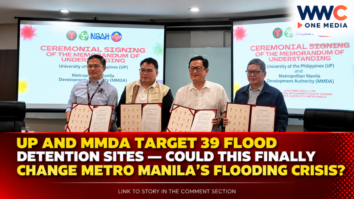
MANILA, Philippines — The University of the Philippines (UP) and the Metropolitan Manila Development Authority (MMDA) are joining forces to strengthen Metro Manila’s defenses against flooding, combining scientific research, hazard assessment and infrastructure planning to help communities better cope with heavy rainfall.
The two institutions signed a memorandum of understanding to deepen cooperation on flood mitigation, technical research, data sharing and capacity-building. The partnership supports the government’s Oplan Kontra Baha initiative, which aims to improve flood management through a combination of infrastructure and nature-based solutions.
One of the central initiatives involves studying 39 proposed flood detention sites across Metro Manila. The facilities are intended to temporarily hold excess rainwater and release it gradually, reducing the sudden volume of runoff entering drainage systems, canals, esteros and rivers.
The agreement brings together the MMDA’s operational role in managing metropolitan flood risks and UP’s expertise in disaster resilience, flood modeling and hazard mapping.
39 proposed sites to undergo further study
MMDA Chairperson Romando Artes said the 39 proposed sites were identified through a feasibility study commissioned by the Department of Environment and Natural Resources (DENR).
The locations are being evaluated to determine whether detention basins and related facilities can effectively reduce flooding before the government commits public funds to construction.
The UP Resilience Institute and its Nationwide Operational Assessment of Hazards (UP NOAH) Center have also proposed more than 150 potential sites in Quezon City alone, highlighting the importance of detailed, location-specific assessment.
Officials have emphasized that flood-control facilities cannot simply be placed anywhere. Their effectiveness depends on factors such as the volume of water they can capture, the surrounding drainage network, local terrain and the way water moves through neighboring communities.
The studies are intended to help authorities prioritize locations where interventions could deliver the greatest benefits.
How detention basins could reduce flooding
A flood detention basin is designed to temporarily collect excess rainwater during heavy rainfall and release it at a controlled rate.
Instead of allowing large volumes of runoff to rush immediately into already strained waterways, the facility slows the flow and gives drainage systems more time to carry the water away.
Depending on the site, detention facilities may be built underground or integrated into open spaces and community infrastructure. Some proposals involve placing water-storage facilities beneath areas such as basketball courts, allowing land to continue serving public uses while providing additional flood-management capacity.
The concept is part of the broader “sponge city” approach, which seeks to help urban areas absorb, retain and gradually release rainwater rather than allowing it to flow rapidly across paved surfaces.
However, detention basins are not a standalone solution. Their performance depends on available storage, maintenance, rainfall intensity and whether downstream drainage systems can handle the released water.
UP brings science and historical flood data into the partnership
UP President Angelo Jimenez said the agreement provides a framework for cooperation in research, technical assistance, knowledge sharing, capacity-building and the development of practical tools to support flood management.
The university’s research teams can contribute scientific analysis to help authorities understand how rainfall, waterways, land development and drainage infrastructure interact.
UP Resilience Institute executive director Alfredo Mahar Lagmay has also highlighted the value of historical maps in identifying waterways that may have been built over as Metro Manila expanded.
Such information could help planners understand where water naturally flowed before urban development altered the landscape, providing additional evidence for flood-control planning.
UP NOAH’s hazard-mapping and modeling capabilities could also support the identification of areas vulnerable to flooding and help authorities assess how proposed interventions might affect communities downstream.
MMDA wants stronger flood forecasting across Metro Manila
The partnership could also support improvements in the monitoring and forecasting of flood risks.
The MMDA has been exploring the expansion of its Efficient Flood Control Operating System (EFCOS), which monitors rainfall and water conditions in parts of the Marikina River system.
A broader monitoring network could help officials obtain information about rainfall volumes and locations earlier, which could then be analyzed alongside flood simulations and hazard data.
More comprehensive information could improve preparedness, help authorities identify areas at risk and support faster decisions during severe weather.
Earlier reporting by the Philippine Information Agency also documented cooperation between the MMDA and UP Resilience Institute on data sharing, disaster-risk assessment and the development of tools similar to the former Project NOAH.
Such coordination is important because floodwater does not stop at city boundaries. Heavy rainfall in one area can affect rivers, drainage channels and downstream communities elsewhere in the metropolis.
Flooding remains a costly threat to communities
Metro Manila’s exposure to flooding is intensified by dense development, extensive paved surfaces, pressure on drainage infrastructure and increasingly severe rainfall events.
In August, severe monsoon rains and tropical cyclones affected about 9.6 million people across Metro Manila, Calabarzon and the Visayas, causing 44 deaths and more than ₱8 billion in infrastructure damage, according to figures cited by UP officials in reporting by the Daily Tribune.
Flooding can also disrupt public transportation, damage homes and commercial properties, interrupt work and schooling, and expose residents to contaminated water.
These consequences make flood mitigation a public-safety and economic priority, not simply an infrastructure concern.
Officials are therefore pursuing a combination of measures that may include detention basins, drainage improvements, improved monitoring, nature-based interventions and better coordination among agencies and local governments.
Other flood projects are already being planned
The UP-MMDA partnership is part of a wider government effort to strengthen Metro Manila’s flood defenses.
In October, the MMDA and Manila city government also moved forward with plans for three rainwater impounding facilities at Remedios Circle, Rajah Sulayman Park and the ASEAN Garden area near the Cultural Center of the Philippines complex.
The proposed facilities are intended to capture excess stormwater and reduce pressure on existing drainage systems. The projects form part of the broader Metro Manila Sponge City Program.
Separately, the MMDA has identified five priority catchment projects targeted for completion by June 2027, subject to implementation and funding arrangements. These include proposed sites at Miriam College, Camp Aguinaldo and the University of the Philippines Diliman in Quezon City, along with locations in Manila.
The projects illustrate the government’s growing emphasis on temporary water storage and better management of runoff. Their eventual impact will depend on whether they are properly designed, funded, built and maintained.
Will the partnership finally ease Metro Manila’s flooding?
The UP-MMDA agreement creates a stronger framework for applying scientific research to flood-management decisions. But signing an agreement and identifying possible sites are only the first steps.
The next challenges include completing the necessary studies, selecting priority locations, securing funding, coordinating with affected communities and ensuring that the facilities work together with existing drainage and flood-control infrastructure.
Officials have also acknowledged that no single intervention can eliminate flooding, particularly as climate change and intense rainfall increase the pressure on urban systems.
For residents who face recurring floods, the real measure of success will be whether these plans eventually translate into lower flood levels, shorter periods of inundation and fewer disruptions during heavy rains.
The partnership marks an important step toward more science-based flood management. Whether it delivers lasting protection will depend on implementation—and on the government’s ability to combine infrastructure, sound urban planning and reliable early-warning systems into one coordinated strategy.