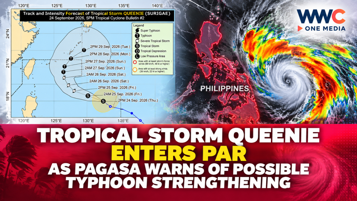
Tropical Storm Queenie has entered the Philippine Area of Responsibility, prompting closer monitoring as the weather system gradually strengthens over the Philippine Sea.
Queenie, internationally known as Surigae, entered the PAR on Thursday, Sept. 24. At the time, it was packing maximum sustained winds of 75 kilometers per hour near the center and gusts of up to 90 kph.
As of Friday morning, Sept. 25, PAGASA said Queenie was about 860 kilometers east of Extreme Northern Luzon and moving west-northwestward at 25 kph. Its strength remained at 75 kph, with gusts reaching 90 kph.
No Tropical Cyclone Wind Signal has been raised over any part of the country. PAGASA currently expects Queenie to remain offshore and says the storm is unlikely to directly affect the Philippines throughout the forecast period.
However, the storm’s outer circulation and trough may still bring weather effects to some areas. Earlier forecasts indicated that Batanes, the Babuyan Islands and Ilocos Norte could experience strong to gale-force winds, while coastal waters in Northern Luzon could become moderate.
PAGASA is also warning that heavy rainfall and severe winds can still occur outside the storm’s projected landfall area and forecast confidence cone, depending on how the system develops and its eventual track.
The weather bureau expects Queenie to continue moving west-northwestward before shifting northwestward on Saturday. By Saturday afternoon, the system is forecast to slow down and begin turning toward the northeast.
Queenie is expected to gradually intensify while inside the PAR and could reach typhoon strength by Sunday, Sept. 27. PAGASA forecasts that the system will exit the Philippine Area of Responsibility between Sunday afternoon and evening before moving farther northeast away from the country.
The storm is therefore not currently projected to make landfall in the Philippines, but its development remains important because changes in strength or direction could alter local weather conditions, particularly over northern areas and surrounding waters.
For now, authorities are advising residents and disaster-response offices to continue monitoring official PAGASA bulletins as Queenie develops over the Philippine Sea.