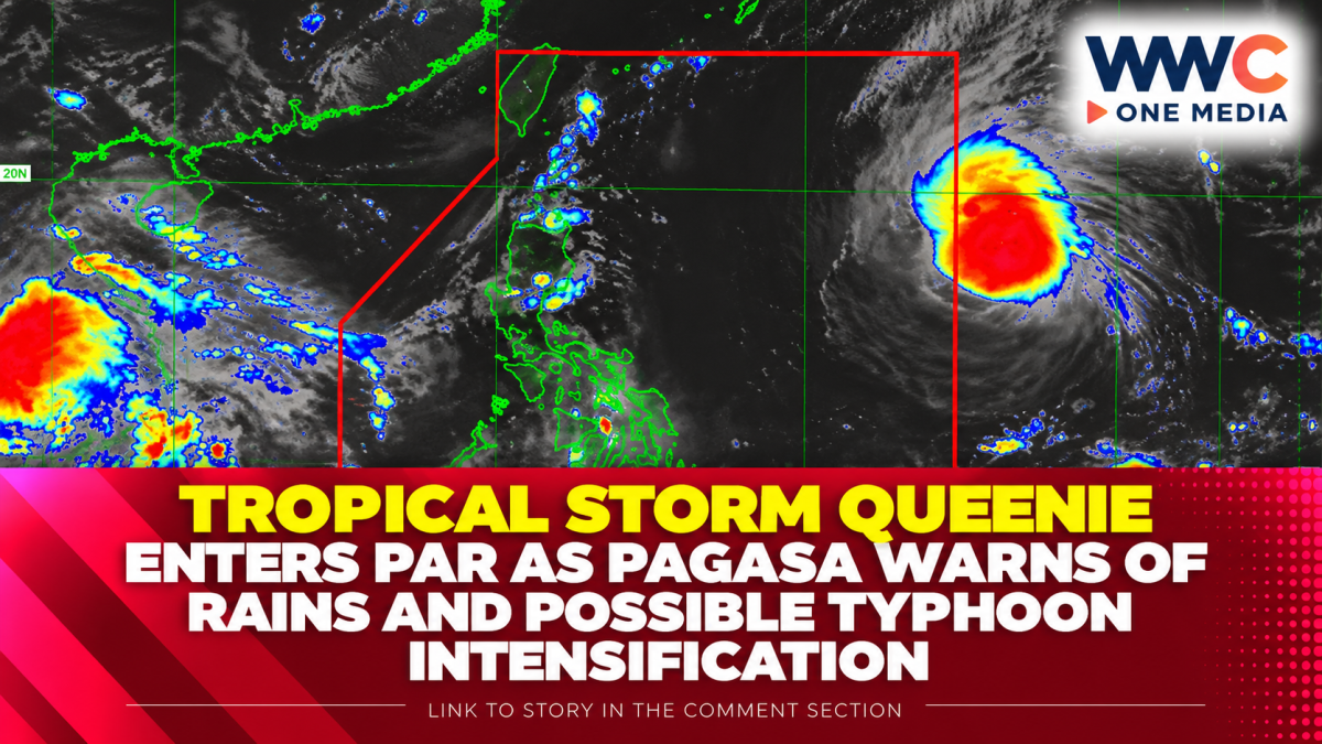
Tropical Storm Surigae has entered the Philippine Area of Responsibility and was given the local name Queenie, bringing renewed weather concerns as PAGASA forecasts rain, strong winds and possible further intensification in the coming days.
Queenie entered PAR on Thursday, September 24, and as of PAGASA’s 11 a.m. bulletin, its center was estimated 1,310 kilometers east of Northern Luzon. The storm was packing maximum sustained winds of 75 kilometers per hour near the center, with gustiness of up to 90 kph, while moving west-northwestward at 35 kph.
Even before entering PAR, the storm’s trough was already affecting parts of the country. PAGASA reported cloudy conditions with scattered rain showers and thunderstorms over Biliran, Leyte, Southern Leyte, Dinagat Islands, Surigao del Norte and Surigao del Sur. Moderate to heavy rainfall in these areas could trigger flash floods and landslides.
The weather system is also expected to bring isolated rain showers or thunderstorms over Bicol and other parts of Eastern Visayas, while localized thunderstorms may affect other areas. PAGASA has warned that heavy rain and severe winds can occur outside the storm’s projected track or forecast confidence cone.
For Mindanao, stronger winds are expected as Queenie’s circulation and trough influence the region. PAGASA forecasts strong to gale-force gusts over Davao Oriental, Davao Occidental and Sarangani from Friday through Saturday, particularly in exposed coastal and upland areas.
No Tropical Cyclone Wind Signal had been raised anywhere in the country as of the 11 a.m. bulletin. PAGASA, however, advised residents in areas vulnerable to flooding, landslides and strong winds to remain alert and follow instructions from local authorities.
The storm is forecast to move generally west-northwestward through Friday before turning toward the north-northeast by Monday. PAGASA expects Queenie to leave PAR by Tuesday morning, September 29.
Queenie is also expected to gradually strengthen while inside PAR and could reach typhoon intensity by Sunday, September 27. The forecast remains subject to changes as the storm moves, making updated PAGASA advisories important for communities and local disaster-response offices.
With the system still far from land, the immediate concern is not a direct landfall but the rain and wind hazards associated with its trough and outer circulation. Residents in affected areas, particularly those near rivers, steep slopes and exposed coastlines, are being urged to monitor weather bulletins as conditions develop.