
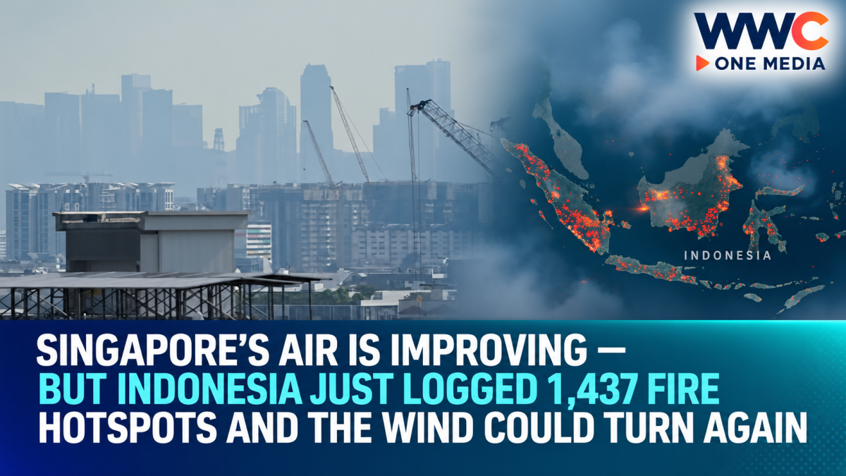
JAKARTA/SINGAPORE — Singapore woke to cleaner air Wednesday after an islandwide bout of unhealthy haze, but the crisis producing that smoke is far from over.
Across Indonesia, firefighters are battling one of the country’s most intense wildfire seasons in more than a decade, with 1,437 high-confidence hotspots detected as of Monday night and hazardous pollution readings still being recorded across parts of Kalimantan.
Indonesia is expanding firefighting operations beyond six priority provinces as smoke continues crossing national borders into Singapore, Malaysia and Brunei.
And that means Wednesday’s improvement in Singapore may offer relief—but not necessarily an end to the haze.
The crucial variable is now something no government can control directly:
the wind.
Singapore improves after its first islandwide unhealthy haze in seven years
Singapore’s 24-hour Pollutant Standards Index returned to the moderate range across all five regions by late Wednesday morning, after the central region eased to a PSI of 99 at 11 a.m.
That was a sharp improvement from Tuesday, when all five regions entered the unhealthy range for the first time since 2019.
As of 11 a.m. Wednesday, CNA reported PSI readings of:
99 in central Singapore, 85 in the west, 83 in the east, 76 in the north and 74 in the south.
Under Singapore’s system, PSI readings from 51 to 100 are considered moderate, while 101 to 200 are unhealthy.
But the improvement should not be mistaken for the disappearance of the regional fire threat.
Singapore’s NEA said Tuesday evening that dry conditions were expected over central and southern Sumatra and southern Kalimantan, while prevailing southeast-to-south winds could continue carrying smoke toward Singapore.
It forecast the 24-hour PSI in the high-moderate to mid-unhealthy range, depending largely on fire activity and wind direction.
That is the central uncertainty hanging over Singapore:
the fires can remain hundreds of kilometres away and still change air quality rapidly if the winds line up.
Indonesia recorded 1,437 hotspots
The scale of the problem becomes clearer across the Java Sea.
Indonesia recorded 1,437 high-confidence fire hotspots as of Monday night, according to Forestry Ministry data reported by Bernama.
Central Kalimantan alone accounted for 689 hotspots, followed by:
West Kalimantan: 203
South Sumatra: 116
South Kalimantan: 112
Jambi: 9
No high-confidence hotspots were detected in Riau during that particular monitoring period.
The ASEAN Specialised Meteorological Centre was simultaneously observing transboundary smoke over Singapore and Peninsular Malaysia.
This is why the haze can seem to improve in one country while worsening somewhere else.
The fires are spread across enormous areas, and changing winds continuously redirect the smoke.
Some pollution readings in Kalimantan are extraordinarily high
The conditions inside Indonesia are far more severe than those being experienced in Singapore.
At noon Wednesday, Indonesia’s Environment Ministry data showed hazardous air quality in several parts of Kalimantan.
South Barito in Central Kalimantan recorded an Indonesian Air Pollution Standard Index, or ISPU, reading of 920, while Murung Raya reached 761.
Under Indonesia’s system, anything above 300 is classified as hazardous.
Those numbers use a different national index from Singapore’s PSI and Malaysia’s API, so they should not be compared point-for-point.
But they illustrate the extreme pollution confronting some communities closest to the fires.
In West Kalimantan’s capital Pontianak, residents have spent days moving through thick smoke that has reduced visibility and made ordinary outdoor activity difficult.
Reuters described the current fire season as Indonesia’s most intense in 11 years, driven by severe drought associated with exceptionally strong El Niño conditions.
More than 113,000 respiratory cases recorded
The crisis is increasingly becoming a public-health emergency inside Indonesia.
Health Ministry figures showed 113,336 wildfire-related acute respiratory infection cases as of September 9, more than double the 50,891 cases recorded on September 1.
More than 12.5 million people across seven provinces on Sumatra and Borneo have been exposed to wildfire haze, according to ministry data cited by Reuters.
Young children are among the groups most affected.
CNA reported that more than 26,500 children under five were among the respiratory cases recorded by September 9.
In Pontianak, Reuters reported that volunteers have even begun distributing oxygen cylinders to homes and firefighters under an initiative called Rumah Oksigen, or Oxygen House, as some residents struggle with shortness of breath, coughing and sore throats.
The haze reaching neighbouring countries is therefore only one part of the disaster.
For communities beside Indonesia’s burning forests and peatlands, the smoke is already a daily health problem.
Malaysia is now seeing widespread unhealthy air
Malaysia’s air quality also deteriorated Wednesday.
CNA reported that 40 areas were recording unhealthy Air Pollutant Index readings as of 8 a.m.
Johan Setia in Selangor had the highest reported reading at 182, followed by Cheras in Kuala Lumpur at 179 and Nilai in Negeri Sembilan at 178.
Putrajaya, Shah Alam and Seremban were also among locations with unhealthy air.
Malaysia classifies API readings of 101 to 200 as unhealthy, 201 to 300 as very unhealthy and readings above 300 as hazardous.
Parts of Malaysian Borneo have already experienced much more severe conditions during this fire season.
Earlier this month, authorities declared an air-quality emergency in the Sarawak district of Serian before lifting it as conditions improved.
That episode demonstrated how quickly the regional smoke plume can shift.
Indonesia is widening its firefighting campaign
Indonesia’s National Disaster Mitigation Agency, or BNPB, has responded by expanding fire-control operations beyond its original six priority provinces of Riau, Jambi, South Sumatra, West Kalimantan, South Kalimantan and Central Kalimantan.
Firefighting operations are now also taking place in areas including:
East Java, North Maluku, Central Java, North Kalimantan, Central Sulawesi, Lampung and Southeast Sulawesi.
Aircraft have been deployed for water bombing around areas including Bromo Tengger Semeru National Park and Mount Butak in East Java.
Indonesia had 53 aircraft deployed as of Tuesday—34 for water bombing and 19 for aerial patrol—alongside weather-modification operations intended to encourage rainfall.
Japan has also joined the response, sending three CH-47 Chinook helicopters and about 180 personnel to support firefighting operations.
Those resources demonstrate the scale of the response.
But they also reveal how difficult these fires are to extinguish.
Why peat fires are especially dangerous
One reason Indonesia’s haze crises can persist for weeks is peat.
Peatlands consist of partially decomposed organic material that stores enormous amounts of carbon.
When sufficiently dry, peat does not simply burn on the surface.
Fire can smoulder underground, sometimes beyond the reach of ordinary firefighting techniques, continuing to release smoke even after visible flames disappear.
That makes detecting and extinguishing every active fire difficult.
Reuters reported that scientists warn satellite estimates may even undercount emissions because some underground peat fires cannot be easily observed from space.
The resulting smoke contains very fine particles, including PM2.5, capable of penetrating deep into the respiratory system.
That is why health authorities across Southeast Asia pay particularly close attention to PM2.5 measurements during haze episodes.
The emissions numbers are enormous
The 2026 wildfire season is also producing a major climate impact.
Indonesia generated an estimated 19.7 million metric tons of wildfire carbon dioxide emissions from September 1 through September 7, according to data from the European Union’s Copernicus monitoring system cited by Reuters.
That represented more than one-third of estimated global wildfire emissions during that week.
Emissions were also about 273% above the seasonal average, approaching levels associated with Indonesia’s devastating 2015 fire season.
Government figures showed about 202,000 hectares had burned between January and July.
The environmental group YKAN separately estimated that another 600,000 hectares may have burned during August alone. That August figure is an NGO estimate, not an Indonesian government total.
The distinction matters because burned-area estimates can vary significantly depending on satellite methods and reporting periods.
Still, every major indicator points in the same direction:
2026 has become an unusually severe Indonesian fire year.
El Niño created the conditions for a dangerous haze season
The warning signs were visible months ago.
At an ASEAN ministerial meeting in Bali in July, regional officials noted that El Niño conditions had developed and were expected to strengthen through August and September.
A positive Indian Ocean Dipole was also expected, while below-normal rainfall was forecast across much of southern Southeast Asia.
ASEAN officials explicitly warned that those conditions could increase fire hotspots and the risk of prolonged transboundary smoke haze.
That forecast has largely materialised.
Dry forests and peatlands become substantially more combustible during prolonged drought.
Once fires begin—whether accidentally, naturally or through human land-clearing activity—they can spread much more quickly and become much harder to extinguish.
What actually causes Indonesia’s fires?
Weather creates the conditions, but it does not explain every ignition.
Indonesia has long struggled with fires associated with land clearing, agriculture and plantations, particularly in peat-rich areas.
Using fire can be cheaper than clearing vegetation mechanically.
Indonesia prohibits many forms of open burning, and authorities regularly investigate individuals and businesses suspected of illegal fires.
But enforcement across a country of more than 17,000 islands and vast forest and plantation areas is difficult.
The recurring haze problem therefore involves a combination of climate conditions, land management, peat drainage, agricultural practices and law enforcement rather than a single cause.
ASEAN already has a haze treaty
The regional political response is not new either.
ASEAN members adopted the ASEAN Agreement on Transboundary Haze Pollution more than two decades ago, creating mechanisms for cooperation, monitoring and firefighting assistance.
But severe haze episodes have repeatedly returned.
At its July meeting, ASEAN countries discussed improving haze-dispersion modelling, burnt-area mapping, research cooperation and financing for the regional haze-control framework.
The 2026 crisis is now testing how much those mechanisms can achieve when weather conditions become exceptionally dry and fires are already widespread.
Singapore’s cleaner Wednesday may not last
For Singapore residents, Wednesday morning’s return to moderate air quality was significant.
At least temporarily, the island had moved away from the unhealthy readings seen Tuesday.
But NEA’s latest advisory makes clear that conditions can change.
Smoke was being transported toward Singapore from Kalimantan and Sumatra, and dry weather was expected to persist in important fire-prone areas.
That means Singapore’s air quality may depend heavily on the next shift in prevailing winds.
NEA advises healthy people to reduce prolonged or strenuous outdoor exertion when the 24-hour PSI reaches unhealthy levels. Elderly people, pregnant women and children should minimise prolonged strenuous outdoor exertion, while people with chronic heart or lung disease should avoid it.
For immediate decisions, the agency recommends looking at the one-hour PM2.5 reading, while the 24-hour PSI forecast is intended for planning activities ahead.
The haze has crossed borders—but the fires have not peaked everywhere
That is the most important distinction in the latest update.
Singapore’s air improved Wednesday.
Malaysia’s remained unhealthy across dozens of locations.
Inside Indonesia, some communities were still recording pollution far into the hazardous category.
And Indonesian authorities say firefighting operations are being expanded rather than scaled down.
So the regional haze crisis cannot be judged by whether one skyline looks clearer on one morning.
As long as drought persists, peat continues burning and hundreds of hotspots remain active, Southeast Asia remains vulnerable to another plume.
Singapore may be breathing easier today—but with 1,437 Indonesian hotspots recently detected and the dry season still underway, the next chapter of the haze crisis may be only a wind shift away.




Leave a Reply