
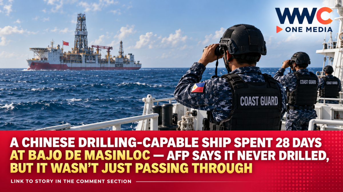
MANILA, Philippines — A Chinese research vessel capable of drilling hundreds of meters into the seabed spent nearly a month operating around Bajo de Masinloc, but Philippine military authorities now say there is no evidence that it actually drilled beneath the disputed waters.
The distinction matters.
The Haiyang Dizhi Shihao, a 76-meter Chinese research and survey vessel, remained in the vicinity of Bajo de Masinloc—also known as Panatag or Scarborough Shoal—for 28 days, triggering concern after Philippine authorities disclosed that the ship was equipped for deep-sea drilling.
But Armed Forces of the Philippines special spokesperson for the West Philippine Sea Rear Admiral Roy Vincent Trinidad said Tuesday that surveillance data did not show the vessel stopping long enough to conduct seabed drilling.
Instead, its movement pattern was consistent with research or surveillance activity, Trinidad said.
That does not end the dispute.
The Philippine Coast Guard says the ship conducted research without authorization from Manila, while China maintains that activities around what it calls Huangyan Dao fall within Chinese sovereign rights.
The disagreement is now less about whether a drill entered the seabed—and more about what information the vessel may have collected during four weeks in one of the most contested areas of the South China Sea.
AFP: A drilling ship would have had to stay still
Trinidad said Philippine monitoring systems found no confirmed seabed drilling during the vessel’s stay.
“To be able to conduct drilling activities, it should be stationary.”
According to the AFP, the ship’s recorded tracks did not show the kind of sustained stationary positioning expected during drilling operations. The military said its sensors and coordination with other Philippine agencies likewise produced no confirmation that drilling occurred.
That is an important clarification from earlier coverage.
When the Philippine Coast Guard first disclosed the vessel’s presence in early September, spokesperson Rear Admiral Jay Tarriela emphasized that the Haiyang Dizhi Shihao was drilling-capable.
Tarriela said the vessel had previously demonstrated that capability, including a reported operation in 2023 in which it drilled more than 300 meters beneath the seafloor. But even then, the Coast Guard did not say it had confirmed drilling at Bajo de Masinloc.
Capability and confirmed activity are two different things.
The AFP’s latest assessment narrows the claim: research appears likely; actual drilling was not detected.
The ship spent 30 days inside waters Manila considers part of its EEZ
The Coast Guard’s final tracking timeline says the Haiyang Dizhi Shihao entered the Philippine exclusive economic zone on August 10 and arrived near Bajo de Masinloc the following day.
It remained around the shoal until September 8, exited the Philippine EEZ late on September 9 and was back near Guangdong by September 11.
According to the PCG timeline, that amounted to about 30 days inside the Philippine EEZ and 28 days in the vicinity of Bajo de Masinloc.
Philippine authorities said the Department of Foreign Affairs had not issued China a permit for marine scientific research associated with the voyage.
Tarriela also said the vessel intermittently stopped transmitting its Automatic Identification System signal.
The Coast Guard continued tracking it using Canada’s Dark Vessel Detection program, which uses satellite technology to detect ships even when conventional tracking transmissions are absent.
Why the lack of a permit matters
Under the United Nations Convention on the Law of the Sea, marine scientific research conducted in a country’s exclusive economic zone or continental shelf generally requires the consent of that coastal state.
UNCLOS Article 246 states that coastal states have the right to regulate and authorize marine scientific research in those areas. It also specifically allows a state to withhold consent when a research project involves drilling into the continental shelf.
That is the legal framework Manila cites in objecting to unauthorized Chinese surveys in waters it regards as part of its EEZ.
There is an important legal nuance around Bajo de Masinloc itself, however.
The 2016 South China Sea arbitral tribunal did not decide whether China or the Philippines has sovereignty over Scarborough Shoal. Sovereignty over land territory was outside the tribunal’s mandate.
What the tribunal did determine was that Scarborough Shoal is a high-tide feature incapable of generating its own 200-nautical-mile EEZ or continental shelf. It also rejected China’s claim to historic rights over vast areas inside the so-called nine-dash line where those claims exceeded maritime entitlements allowed by UNCLOS.
That distinction is often lost in political coverage.
China rejects Manila’s interpretation
Beijing does not accept the Philippine position.
China calls Bajo de Masinloc Huangyan Dao and says it has sovereignty over the shoal and surrounding waters.
Chinese officials have repeatedly said scientific research around the feature is within China’s rights. In June, Foreign Ministry spokesperson Lin Jian said China regarded its scientific activities around Huangyan Dao as an exercise of sovereign rights and rejected Philippine objections.
The Chinese government also rejects the 2016 arbitral ruling and maintains that the award has no legal validity.
The Philippines takes the opposite position: Manila says the award is final and binding under UNCLOS, to which both countries are parties.
Those competing positions are central to almost every confrontation around the shoal.
The ship may not have drilled, but research can still be strategically valuable
Seabed drilling is only one form of oceanographic activity.
Survey vessels can collect information on water depth, seafloor contours, geological structures, currents and other physical characteristics of the marine environment without necessarily drilling into the seabed.
The AFP’s assessment that the Haiyang Dizhi Shihao was apparently conducting research or surveillance therefore does not mean it was simply transiting through the area. Trinidad said the vessel’s track indicated more than ordinary passage.
This is one reason the Philippines has increasingly focused on research vessels in addition to Chinese coast guard ships and naval vessels.
Scientific and hydrographic data can have legitimate civilian uses, including environmental research and resource assessment. Detailed seabed information can also have maritime-navigation and other strategic applications.
Philippine authorities have therefore sought greater transparency about what data foreign research vessels collect in areas where Manila claims maritime jurisdiction.
After the Haiyang Dizhi Shihao left, the PCG called on China to disclose information gathered during the mission.
Bajo de Masinloc was already seeing a heavy Chinese presence
The research vessel’s deployment did not occur in isolation.
AFP figures show that 23 Chinese coast guard and naval vessels were monitored around Bajo de Masinloc during August, including 14 China Coast Guard vessels and nine People’s Liberation Army Navy ships.
During September 1 to 7 alone, the AFP reported another 14 Chinese military and coast guard vessels in the area—four PLAN ships and 10 China Coast Guard vessels.
Those figures fluctuate and do not mean all ships remained there simultaneously throughout the reporting periods. But they illustrate how persistently the shoal is being monitored and patrolled by both sides.
The Philippines has also continued deploying coast guard, military and fisheries vessels and conducting maritime-domain-awareness operations around the area.
Why this shoal matters so much
Bajo de Masinloc lies roughly 124 nautical miles west of Zambales, putting it much closer to Luzon than to the Chinese mainland.
It is also a traditional fishing ground.
The 2016 arbitral tribunal found that fishermen from the Philippines, China and Vietnam had historically used the shoal and ruled that China had violated the traditional fishing rights of Filipino fishermen when it prevented them from accessing the area following the 2012 standoff.
China has maintained effective coast guard presence around the shoal since that confrontation.
That makes every new vessel, scientific platform, coast guard deployment or military exercise politically sensitive.
Earlier in 2026, China and the Philippines also traded accusations over research activity, patrols and structures around the same feature. Beijing said scientific research there was lawful under its sovereignty claim; Manila rejected that position.
This is not the first time China and the Philippines disagreed over what ships were doing there
The Haiyang Dizhi Shihao episode also follows disputes over Chinese military activity around Bajo de Masinloc.
In May, Beijing announced that Chinese forces had conducted military drills near the shoal.
At the time, the AFP disputed the description, saying its own monitoring showed Chinese vessels present but found no organized formations or tactical maneuvers that would constitute a coordinated exercise.
By August, however, the AFP confirmed separate Chinese naval-air exercises in the area while stressing that military activity did not determine the legal status of the shoal.
That history demonstrates why wording matters in West Philippine Sea reporting.
A vessel can be drilling-capable without drilling.
Ships can be present without conducting a coordinated exercise.
And surveillance data can establish that a vessel remained in an area without necessarily revealing everything it was doing below the waterline.
The drilling question may be settled — the research question is not
For now, Philippine authorities have reached a more specific conclusion about the Haiyang Dizhi Shihao.
There is no confirmed evidence of seabed drilling.
The AFP says the ship’s track instead indicates research or surveillance activity.
But that answer opens another question.
What exactly did the Chinese vessel measure or record during its 28 days around Bajo de Masinloc?
Philippine authorities say Manila never authorized the mission. China says it did not need Philippine permission because Beijing considers the shoal and adjacent waters Chinese territory.
So the newest chapter in the Scarborough Shoal dispute is not about a drill boring into the seabed.
It is about something less visible but potentially just as consequential: who gets to map, study and collect information in one of the most strategically contested stretches of water in Southeast Asia.




Leave a Reply