
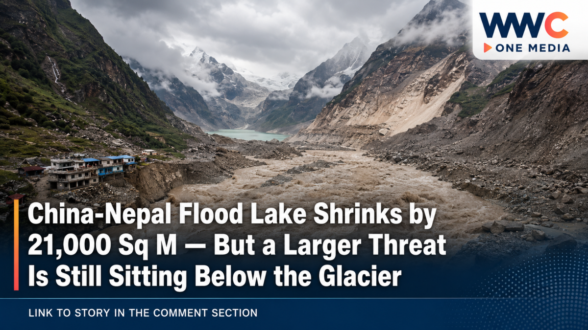
BEIJING/KATHMANDU — A dangerous lake formed in the wreckage of this week’s catastrophic Himalayan flood is beginning to shrink, easing fears that another wall of water could sweep through the devastated China-Nepal border region.
But the danger is far from over.
Chinese authorities said Saturday that satellite images showed the barrier lake gradually draining, reducing its surface area to about 99,000 square meters, or roughly 14 football fields. That is about 21,000 square meters smaller than it was on Thursday, according to China’s Water Resources Ministry.
The development is one of the first encouraging signs since the August 26 disaster.
However, authorities are now closely monitoring another, even larger body of water near the bottom of the glacier-collapse zone. Chinese geohazard specialists estimate its surface area at more than 120,000 square meters, but its depth — and therefore the amount of water it may be holding — remains unknown.
That uncertainty means communities and rescue crews downstream cannot yet consider themselves safe.
First lake is draining — but the flood warning remains
The smaller barrier lake formed when massive amounts of ice, rock and debris disrupted river channels following the glacier collapse.
Satellite observations between Thursday and Saturday indicated that water had begun finding a route through the blockage instead of continuing to accumulate behind it.
That reduced pressure on the natural debris dam and lowered the immediate probability of a sudden catastrophic rupture.
But Nepali disaster officials have warned that the flood danger will remain until the unstable bodies of water created by the disaster have fully drained.
The threat was serious enough on Friday to temporarily stop rescue operations.
When water began overflowing from one of the newly created lakes into the river system, teams on both sides of the border were ordered away from dangerous areas. Operations resumed only after authorities determined that the immediate risk had become manageable.
Nearly 3,000 people are still missing
The improving lake situation comes as the human toll from the disaster continues to rise.
By Saturday, the Associated Press reported that 626 people had been confirmed dead in Nepal and seven in China’s Tibet region, bringing the combined confirmed death toll to 633.
Nearly 3,000 people remained missing across the two countries. Chinese authorities alone reported 554 people still unaccounted for.
The numbers have been changing rapidly as previously isolated communities are reached, survivors are identified and authorities reconcile lists of residents, workers and foreign visitors.
More than 3,700 people have been rescued in Nepal, according to AP, while difficult weather, mud, damaged roads and destroyed communications continue to complicate the search.
The International Federation of Red Cross and Red Crescent Societies has estimated that more than 90,000 people have been affected by the catastrophe.
What triggered the disaster?
Evidence reviewed by scientists and news organizations points to a massive collapse involving glacier ice and rock high in the Himalayas on Wednesday.
The falling material crashed hundreds of meters into the valley below, sending enormous quantities of ice, boulders, mud and debris into mountain river systems.
The resulting torrent raced downstream with devastating force, destroying homes, roads, bridges and hydropower infrastructure before engulfing the strategically important Gyirong border crossing, which connects Nepal with China’s Tibet region.
Initial reports raised the possibility that an earthquake had triggered the collapse.
However, the U.S. Geological Survey later determined that the seismic signal detected at the time was generated by the collapse of rock and ice itself and the subsequent debris flow, rather than necessarily being evidence of an earthquake occurring beforehand.
Satellite imagery examined by Reuters and AP has shown the enormous physical transformation of the mountain landscape, with previously green slopes buried beneath sediment, rock and debris.
Why scientists remain worried
This week’s disaster also highlights a growing problem across the Himalayas: one natural catastrophe can quickly trigger another.
An ice-rock collapse can block a river.
The blocked river can create a lake.
That lake can then overflow or suddenly breach its debris dam, sending another flood downstream — even after the original disaster has passed.
Scientists interviewed by AP said the newly created lake system contained millions of cubic meters of water. One estimate for an earlier monitored lake placed its volume at the equivalent of roughly 1,200 Olympic-sized swimming pools.
High temperatures and continued melting could add still more water to unstable areas.
Climate scientists have cautioned against declaring climate change the sole direct cause of this particular collapse before detailed studies are completed. But researchers say rising temperatures can destabilize high-altitude environments by melting glacier ice, weakening permafrost, changing freeze-thaw cycles and increasing water infiltration into mountain slopes.
That combination can make already fragile Himalayan terrain more susceptible to catastrophic failures.
Rescuers return to a landscape of ruins
China has deployed specialized engineering and rescue teams to monitor the unstable lakes and search the disaster zone.
China Anneng, a state-owned emergency engineering company, sent a 15-member monitoring team equipped with reconnaissance drones, portable satellite equipment and mobile surveillance cameras to collect information around the barrier lake.
More than 50 rescuers were searching through boulders, mud and shattered infrastructure Saturday despite rain and difficult conditions.
One of the first Chinese teams to reach the devastated Gyirong border complex had to cross forests and steep terrain after roads disappeared.
What rescuers eventually reached was almost completely destroyed.
Reuters reported that teams found the border-crossing complex reduced largely to ruins.
Nearly 500 villagers and construction workers on the Chinese side have been evacuated, while authorities said all 555 tourists who had been in the affected area were also evacuated.
The disaster could cost Nepal billions
The consequences will extend far beyond the rescue operation.
Nepal Finance Minister Swarnim Wagle told Reuters Saturday that rebuilding after the floods could cost approximately US$4 billion to US$5 billion — potentially close to one-tenth of the country’s economy.
Roads, bridges, towns and major hydropower facilities have been damaged.
Reuters reported that affected power projects represent more than 12% of Nepal’s national electricity-generating capacity, creating another potentially serious problem for an economy heavily dependent on tourism, remittances and hydropower.
The full damage assessment is only beginning.
The immediate danger has eased. The bigger question has not.
The shrinking lake offers rescuers and residents some badly needed relief.
But officials are not declaring the crisis over.
Another larger body of water remains near the glacier-collapse zone. Its depth is unknown. The surrounding terrain remains unstable. Heavy rain and melting ice continue to complicate operations.
And thousands of families are still waiting for word about people who have not been found.
For now, the most important change is that one feared secondary disaster appears less likely than it did a day earlier.
The next question is whether the remaining lake systems can drain safely — before the devastated Himalayan valleys are forced to endure another flood.




Leave a Reply