
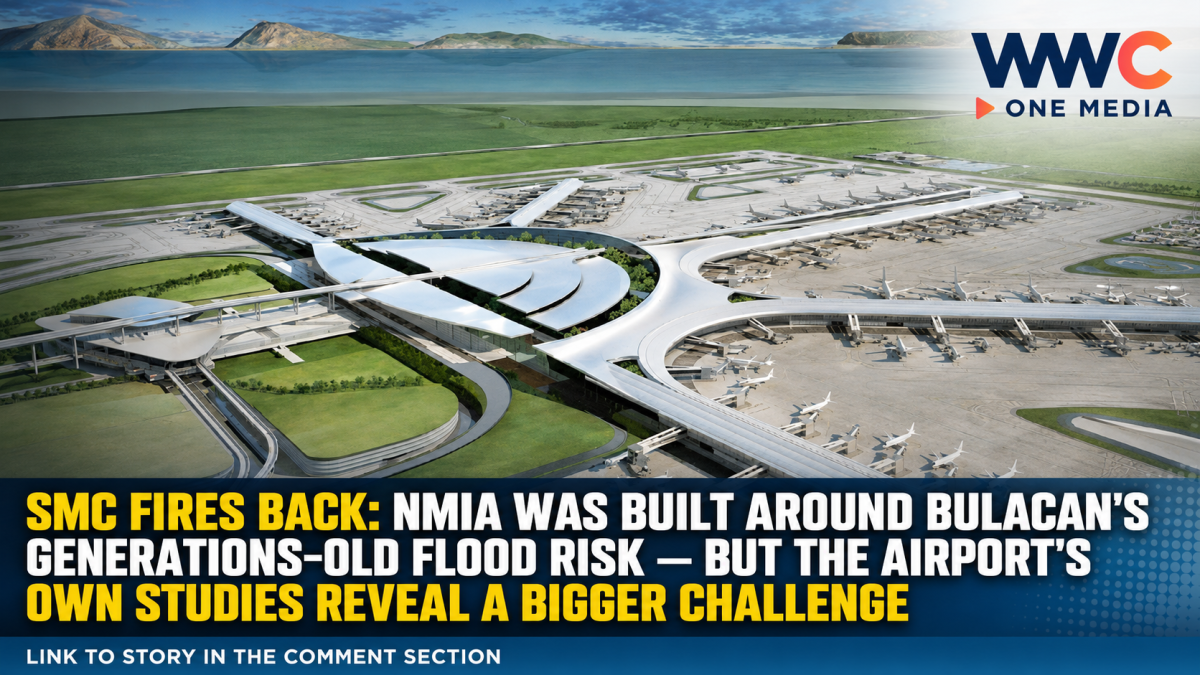
MANILA, Philippines — San Miguel Aerocity Inc. (SMAI), developer of the New Manila International Airport (NMIA) in Bulakan, Bulacan, is pushing back against claims that the massive airport project is responsible for the province’s recent flooding, saying the area’s vulnerability to floods existed for generations and was incorporated into the airport’s design from the beginning.
The statement comes amid renewed public scrutiny of the New Manila International Airport and flooding in Bulacan, with social media posts and public discussions questioning whether the development has altered water flows and contributed to flooding in nearby communities.
SMAI said there is currently no publicly presented hydrological data or technical analysis demonstrating that NMIA caused the recent flooding.
Instead, the company pointed to Bulacan’s naturally vulnerable geography, including its low elevation, limited river capacity, upstream runoff, land subsidence, heavier rainfall and rising sea levels.
“NMIA did not cause Bulacan’s flooding. This is a problem the province has had to contend with for many generations.”
Airport design began with flooding in mind
According to SMAI, detailed studies for the airport’s hydrology and flood risks began in 2018, when Danish engineering specialist DHI examined the surrounding rivers and coastal waters.
The assessment considered historical typhoons, storm surges, rainfall, river flows, land subsidence and the possible effects of developing and raising the airport platform on drainage and flood levels in surrounding areas.
A broader flood assessment completed in 2019 identified the need for engineered improvements to water flow around the project.
By 2021, UK engineering firm Mott MacDonald had consolidated the hydrological models and baseline information as part of the project’s environmental and social assessment.
Those studies concluded that the airport platform would have to be significantly elevated. Current project information places portions of the platform between 3.85 meters and 5.50 meters above mean sea level, taking into account flooding, settlement, subsidence and long-term climate risks.
But the airport’s own environmental studies acknowledge a flood impact risk
This is where the issue becomes more complicated.
The project’s environmental-impact assessment does not simply assume that constructing the airport would have zero effect on surrounding flood behavior.
Instead, the assessment modeled how the creation of the airport platform could affect upstream flooding and concluded that additional river works would be necessary to mitigate the potential impact.
The study examined different options for widening and deepening nearby waterways and recommended dredging sections of the Alipit, Santa Maria and Meycauayan rivers to increase drainage capacity.
The assessment also specifically considered the airport expressway and other potential development-related changes that could constrain water movement during major rainfall events.
In other words, the available technical documents support a more nuanced picture: NMIA was designed with flood risks in mind, but its construction also required flood-mitigation measures because changing the landform could influence water levels.
SMC turns to river dredging
San Miguel has since promoted river rehabilitation and dredging under its Better Rivers PH program.
SMAI says more than 1 million metric tons of silt and waste were removed from three rivers near the airport between 2022 and 2024.
The company says the program has subsequently expanded throughout Bulacan, with its reported total reaching more than 4.3 million metric tons of silt and waste removed as of August 18, 2026.
The three key waterways associated with the airport’s flood-mitigation strategy are the Maycapiz-Taliptip (Alipit), Santa Maria and Meycauayan rivers.
Rather than relying solely on large-scale river widening, the approach developed by DHI and Dutch marine engineering firm Boskalis involved deepening portions of the riverbeds while controlling the bottom width to achieve the desired flow capacity.
Bulacan’s flood problem is bigger than one airport
SMC chairman and CEO Ramon Ang has also argued that flooding in Bulacan cannot be attributed to a single project.
During a September 1 media briefing, Ang pointed to the province’s low-lying terrain, constricted and clogged waterways, structures along natural drainage routes and land subsidence as major factors.
He also rejected claims that the airport had blocked major rivers and said SMC was prepared to continue river cleaning, dredging and other work where local governments and affected communities provide the necessary cooperation and permits.
That argument is consistent with earlier concerns raised by Philippine scientists.
In 2020, then-Phivolcs director Renato Solidum warned that the proposed airport site was highly vulnerable to flooding and sat on soft ground, but also stressed that the hazards could be addressed through proper engineering and construction.
The airport site itself has a complicated history
SMC has repeatedly emphasized that NMIA is not a reclamation project.
The company says the airport is being developed on existing titled land that historically formed part of the landmass but became vulnerable to inundation and was subsequently used for fishponds.
That distinction has become important as debate over flooding and Manila Bay reclamation projects has intensified.
The airport is planned as a major international gateway with multiple runways and significantly greater capacity than the existing Ninoy Aquino International Airport. SMC has previously described the project as a long-term solution to Metro Manila’s airport-capacity constraints.
The bigger question remains flood resilience
The latest SMC statement does not end the debate over NMIA and flooding.
What it does establish is that flooding was a known engineering challenge before construction began, rather than an issue discovered only after development started.
The project’s technical assessments incorporated river behavior, storm surges, land subsidence, extreme rainfall and climate projections. At the same time, those same assessments recognized that changing the site’s elevation could affect flood behavior and therefore required river and drainage interventions.
That leaves the central question less about whether Bulacan has always flooded — it clearly has — and more about whether the airport’s flood-control measures will be sufficient as extreme rainfall, land subsidence and rising sea levels intensify the province’s existing vulnerabilities.
For now, SMC maintains that NMIA was engineered around those risks and is intended to help, rather than worsen, Bulacan’s flood problem. Independent scrutiny of actual flood behavior as construction progresses will remain crucial to determining how well those designs perform in real-world conditions.
WWC MEDIA MJE




Leave a Reply