
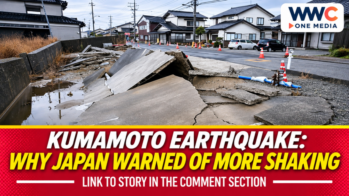
TOKYO, Japan — Nov. 21, 2026. Japan’s Meteorological Agency (JMA) confirmed a magnitude-5.7 earthquake in Kumamoto Prefecture at 2:22 a.m. on Nov. 19, with a preliminary focus about 10 kilometres underground in the Amakusa–Ashikita area. The earthquake produced a maximum seismic intensity of lower 5 in five municipalities, but JMA said the event posed no tsunami threat.
The latest shaking was not an isolated development. JMA classified it as part of the sequence that began with a magnitude-7.1 earthquake in the same region on July 28, making the immediate question how residents and authorities should interpret continued seismic activity months into recovery.
Kumamoto Earthquake: The Official Measurements
JMA’s Nov. 19 bulletin identified the five municipalities registering lower 5 as Kuma Village, Asagiri Town, Minamata City, Ashikita Town and Tsunagi Town. Other areas of Kyushu, Shikoku and the Chugoku region registered lighter shaking on Japan’s intensity scale.
Magnitude and seismic intensity describe different things. Magnitude measures the size of the earthquake at its source; seismic intensity describes how strongly the ground shakes at a particular observation point. The two numbers should not be compared as though they use the same scale.
The depth and magnitude values in the announcement were labelled preliminary. That means later analysis could refine the measurements without changing the fact that significant shaking was detected.
Twenty-One Subsequent Tremors Recorded Within Hours
JMA recorded 21 earthquakes with observed intensity of at least 1 after the main event, as of 3:55 a.m. on Nov. 19. Two registered intensity 3, five intensity 2 and 14 intensity 1.
Those figures describe a specific reporting window, not a final count for Nov. 19 or Nov. 21. Continuing earthquake activity may be reported in later agency updates, which should be checked before publishing a newer total.
JMA advised people in strongly shaken areas to remain alert for approximately a week to further earthquakes capable of producing shaking around lower 5. It said the first two to three days were a particularly important period for vigilance and that even stronger shaking could occur.
Analysis: This is a risk advisory, not a prediction that a particular earthquake will happen on a particular date. Readers should distinguish a warning based on observed seismic patterns from a guaranteed forecast.
Why the July Disaster Still Matters
The agency explicitly placed the Nov. 19 event within the activity associated with the July 28 magnitude-7.1 earthquake. It also identified the Hinagu fault zone in the vicinity of the latest earthquake’s source.
That connection is important for public understanding. A new event occurring months after the largest shock need not represent an entirely separate geological episode. However, the existence of a nearby fault zone does not by itself establish that a particular fault segment ruptured on Nov. 19.
WWC previously examined the damage and recovery costs from Kumamoto’s July earthquake. The earlier recovery burden is relevant context for why continued shaking matters, although the November bulletin does not quantify additional repair costs.
Kumamoto Prefecture continues to maintain official information on recovery and support following the 2026 earthquake sequence. Such administrative updates help distinguish existing reconstruction work from damage caused specifically by the latest tremor.
No Tsunami Threat, but Local Hazards Remain
JMA stated that the Nov. 19 earthquake did not create a tsunami concern. That determination is specific to this event; it should not be broadened into a claim that future offshore earthquakes in the region cannot generate a tsunami.
The agency also warned that places with strong shaking could be more susceptible to falling rocks and landslides. That is especially relevant when people travel along slopes or inspect damaged areas after an earthquake.
Analysis: Public safety information is most useful when risks are separated clearly. A no-tsunami assessment does not eliminate the need to consider unstable terrain, weakened structures or follow-up shaking.
That same distinction between an earthquake’s magnitude and its consequences appears in WWC’s coverage of the Ogasawara offshore earthquake. The Ogasawara event is unrelated to the Kumamoto sequence, and its outcome should not be used to infer conditions in southern Japan.
What Japan’s Monitoring Can and Cannot Tell Residents
JMA publishes seismic observations and emergency earthquake warning information that can help authorities and the public respond. Its Nov. 19 bulletin also reported long-period ground motion reaching class 2 in the Kumamoto and Amakusa–Ashikita areas.
The published record establishes what was measured and what precautions the agency recommended. It does not, on its own, certify the number of people injured, the number of suspended railway services or the total value of newly damaged property.
WWC has separately examined Japan’s earthquake alert system and previously identified errors. That reporting concerns a different alert episode and should not be taken as evidence that JMA’s measurements for Nov. 19 were erroneous.
Analysis: The clearest way to report unfolding emergencies is to attach each number to its observation time and issuing authority. Early estimates, damage reports and transport updates often change at different speeds.
What Happens Next
Authorities and residents can monitor subsequent JMA bulletins, municipal notices and Kumamoto Prefecture’s disaster-recovery updates. Those records would clarify whether the seismic sequence changes, whether new damage is established and whether temporary restrictions are required.
For now, the official record supports a magnitude-5.7 event, lower-5 shaking in five municipalities, 21 observed follow-up earthquakes within the initial reporting window and no tsunami threat from the main shock. It does not justify treating unverified casualty or transport figures as established facts.
Frequently Asked Questions
When did the November Kumamoto earthquake strike?
JMA recorded it at 2:22 a.m. Japan time on Nov. 19, 2026, in the Amakusa–Ashikita area of Kumamoto Prefecture.
How strong was the earthquake?
Its preliminary magnitude was 5.7, with a maximum observed Japanese seismic intensity of lower 5.
Was there a tsunami warning?
JMA said there was no tsunami concern from this specific earthquake.
Is the earthquake connected to the July 2026 disaster?
Yes. JMA classified the Nov. 19 event as part of the earthquake activity that continued after the region’s July 28 magnitude-7.1 shock.
Did JMA warn about further earthquakes?
Yes. The agency recommended vigilance for approximately one week, particularly during the first two to three days after Nov. 19. It did not predict an exact future event.